Area Overview for TS24 0LY
Photos of TS24 0LY
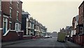
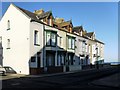
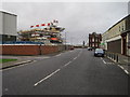
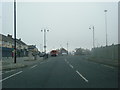
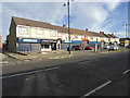


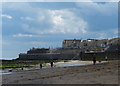
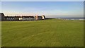


56 photos from this area
Area Information
Key information about the TS24 0LY including its size, population, and administrative classification.
- Area Type
- Postcode
- Area Size
- 3.7 hectares
- Population
- 1457
- Population Density
- 1304 people/km²
House Prices in TS24 0LY
16
Properties
£78,304
Average Sold Price
£29,500
Lowest Price
£115,000
Highest Price
Showing 16 properties
| Address | Type | Beds | Baths | Last Sale Price | Last Sale Date | |
|---|---|---|---|---|---|---|
| 106 Northgate, Hartlepool, TS24 0LY | Terraced | 3 | 1 | £70,000 | Feb 2025 | |
| 94 Northgate, Hartlepool, TS24 0LY | Terraced | 3 | 1 | £115,000 | Jul 2024 | |
| 102 Northgate, Hartlepool, TS24 0LY | Terraced | 2 | 1 | £89,950 | Oct 2023 | |
| 96 Northgate, Hartlepool, TS24 0LY | house | - | - | £90,000 | Jul 2021 | |
| 90 Northgate, Hartlepool, TS24 0LY | house | - | - | £75,376 | Oct 2018 | |
| 92 Northgate, Hartlepool, TS24 0LY | Terraced | - | - | £29,500 | May 1997 | |
| 59A Northgate, Hartlepool, TS24 0LY | Flat | - | - | - | - | |
| Heron Foods, 118 Northgate, Hartlepool, TS24 0LY | retail_financial | - | - | - | - | |
| 114 Northgate, Hartlepool, TS24 0LY | Flat | - | - | - | - | |
| 108 Northgate, Hartlepool, TS24 0LY | house | - | - | - | - |
Page 1 of 2
Energy Efficiency in TS24 0LY
Amenities
Schools
| Rank | School | Type | Entry gender | Ages |
|---|
Explore more schools in this area
Go to Schools tabDemographics
Household Size
One person
most common
Accommodation Type
Houses
most common
Tenure
26
majority
Ethnic Group
White
most common
Religion
N/A
most common
Household Composition
N/A
most common
Age
47
median
Adults (30-64 years)
most common
Household Deprivation
N/A
with no deprivation
NS-SEC
12
in Lower managerial occupations
Explore more demographic insights in this area
Go to Demographics tabPlanning
Planning Constraints
- Flood RiskPremium
- Ramsar Wetland SitesPremium
- Area of Outstanding Natural BeautyPremium
- Protected Nature ReservePremium
- Protected WoodlandPremium