Area Overview for TS23 3TY
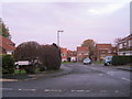
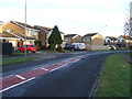
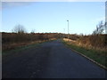
Photos of TS23 3TY
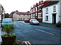
![Wolviston, [old road] footpath north of A1185 in TS23 3TY](https://images.propbar.co.uk/images/geograph/74/23/7423661_120.jpg)
18 photos from this area
Area Information
Key information about the TS23 3TY including its size, population, and administrative classification.
- Area Type
- Postcode
- Area Size
- 1.3 hectares
- Population
- 1180
- Population Density
- 2564 people/km²
House Prices in TS23 3TY
1
Properties
-
Average Sold Price
-
Lowest Price
-
Highest Price
Showing 1 properties
| Address | Type | Beds | Baths | Last Sale Price | Last Sale Date | |
|---|---|---|---|---|---|---|
| The Billingham Grange Independant Hospital, The Billingham Grange, Vincent Road, Billingham, TS23 3TY | hospital_care_home | - | - | - | - |
Energy Efficiency in TS23 3TY
Amenities
Schools
| Rank | School | Type | Entry gender | Ages |
|---|
Explore more schools in this area
Go to Schools tabDemographics
Household Size
One person
most common
Accommodation Type
Houses
most common
Tenure
72
majority
Ethnic Group
White
most common
Religion
N/A
most common
Household Composition
N/A
most common
Age
47
median
Adults (30-64 years)
most common
Household Deprivation
N/A
with no deprivation
NS-SEC
34
in Lower managerial occupations
Explore more demographic insights in this area
Go to Demographics tabPlanning
Planning Constraints
- Flood RiskPremium
- Ramsar Wetland SitesPremium
- Area of Outstanding Natural BeautyPremium
- Protected Nature ReservePremium
- Protected WoodlandPremium