Area Overview for TS22 5FA
Photos of TS22 5FA
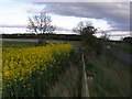
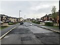
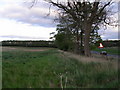
3 photos from this area
Area Information
Key information about the TS22 5FA including its size, population, and administrative classification.
- Area Type
- Postcode
- Area Size
- 21.8 hectares
- Population
- 2856
- Population Density
- 69 people/km²
House Prices in TS22 5FA
35
Properties
£325,542
Average Sold Price
£264,950
Lowest Price
£420,000
Highest Price
Showing 35 properties
| Address | Type | Beds | Baths | Last Sale Price | Last Sale Date | |
|---|---|---|---|---|---|---|
| 42 Bloomfield Drive, Wynyard, TS22 5FA | Detached | 4 | 2 | £335,000 | Oct 2025 | |
| 40 Bloomfield Drive, Wynyard, TS22 5FA | house | - | - | £370,000 | Jul 2023 | |
| 56 Bloomfield Drive, Wynyard, TS22 5FA | house | - | - | £420,000 | Feb 2022 | |
| 46 Bloomfield Drive, Wynyard, TS22 5FA | house | - | - | £318,000 | Sep 2021 | |
| 6 Bloomfield Drive, Wynyard, TS22 5FA | Detached | 4 | 2 | £279,995 | Aug 2021 | |
| 2 Bloomfield Drive, Wynyard, TS22 5FA | Detached | 4 | 2 | £309,995 | Aug 2021 | |
| 4 Bloomfield Drive, Wynyard, TS22 5FA | Detached | 4 | 3 | £414,995 | Mar 2021 | |
| 54 Bloomfield Drive, Wynyard, TS22 5FA | house | - | - | £269,950 | May 2020 | |
| 64 Bloomfield Drive, Wynyard, TS22 5FA | house | - | - | £264,950 | Aug 2019 | |
| 60 Bloomfield Drive, Wynyard, TS22 5FA | house | - | - | £279,950 | Jul 2019 |
Page 1 of 4
Energy Efficiency in TS22 5FA
Amenities
Schools
| Rank | School | Type | Entry gender | Ages |
|---|
Explore more schools in this area
Go to Schools tabDemographics
Household Size
Two person
most common
Accommodation Type
Houses
most common
Tenure
83
majority
Ethnic Group
White
most common
Religion
N/A
most common
Household Composition
N/A
most common
Age
47
median
Adults (30-64 years)
most common
Household Deprivation
N/A
with no deprivation
NS-SEC
47
in Lower managerial occupations
Explore more demographic insights in this area
Go to Demographics tabPlanning
Planning Constraints
- Flood RiskPremium
- Ramsar Wetland SitesPremium
- Area of Outstanding Natural BeautyPremium
- Protected Nature ReservePremium
- Protected WoodlandPremium