Area Overview for TS22 5BQ
Photos of TS22 5BQ
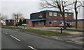
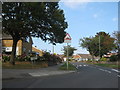
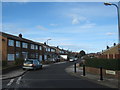
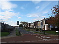
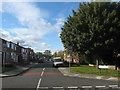
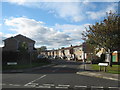
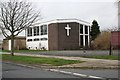
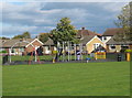
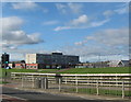
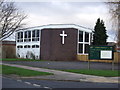
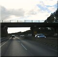
15 photos from this area
Area Information
Key information about the TS22 5BQ including its size, population, and administrative classification.
- Area Type
- Postcode
- Area Size
- 1.9 hectares
- Population
- 1203
- Population Density
- 3845 people/km²
House Prices in TS22 5BQ
37
Properties
£212,902
Average Sold Price
£67,950
Lowest Price
£340,000
Highest Price
Showing 37 properties
| Address | Type | Beds | Baths | Last Sale Price | Last Sale Date | |
|---|---|---|---|---|---|---|
| 149 Whitehouse Road, Billingham, TS22 5BQ | Semi-detached | 3 | 1 | £187,500 | Dec 2024 | |
| 175 Whitehouse Road, Billingham, TS22 5BQ | house | 4 | 1 | £325,000 | Aug 2024 | |
| 163 Whitehouse Road, Billingham, TS22 5BQ | Detached | 4 | 2 | £270,000 | Apr 2024 | |
| 157 Whitehouse Road, Billingham, TS22 5BQ | Detached | 4 | 1 | £280,000 | Aug 2023 | |
| 126 Whitehouse Road, Billingham, TS22 5BQ | Semi-detached | 3 | 1 | £190,000 | Apr 2023 | |
| 141 Whitehouse Road, Billingham, TS22 5BQ | Retail | 3 | 2 | £165,000 | Aug 2022 | |
| 144 Whitehouse Road, Billingham, TS22 5BQ | Retail | 3 | 1 | £275,000 | May 2022 | |
| 183 Whitehouse Road, Billingham, TS22 5BQ | Bungalow | - | - | £217,500 | Apr 2022 | |
| 153 Whitehouse Road, Billingham, TS22 5BQ | house | 3 | - | £180,000 | Mar 2022 | |
| 128 Whitehouse Road, Billingham, TS22 5BQ | Bungalow | 4 | 2 | £280,000 | Dec 2020 |
Page 1 of 4
Energy Efficiency in TS22 5BQ
Amenities
Schools
| Rank | School | Type | Entry gender | Ages |
|---|
Explore more schools in this area
Go to Schools tabDemographics
Household Size
Two person
most common
Accommodation Type
Houses
most common
Tenure
82
majority
Ethnic Group
White
most common
Religion
N/A
most common
Household Composition
N/A
most common
Age
47
median
Adults (30-64 years)
most common
Household Deprivation
N/A
with no deprivation
NS-SEC
31
in Lower managerial occupations
Explore more demographic insights in this area
Go to Demographics tabPlanning
Planning Constraints
- Flood RiskPremium
- Ramsar Wetland SitesPremium
- Area of Outstanding Natural BeautyPremium
- Protected Nature ReservePremium
- Protected WoodlandPremium