Area Overview for TS21 3JN
Photos of TS21 3JN
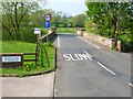
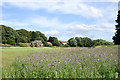

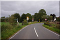
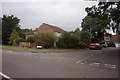
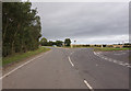
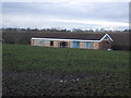
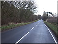
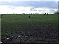
9 photos from this area
Area Information
Key information about the TS21 3JN including its size, population, and administrative classification.
- Area Type
- Postcode
- Area Size
- 17.1 hectares
- Population
- 2937
- Population Density
- 134 people/km²
House Prices in TS21 3JN
33
Properties
£188,530
Average Sold Price
£31,100
Lowest Price
£499,995
Highest Price
Showing 33 properties
| Address | Type | Beds | Baths | Last Sale Price | Last Sale Date | |
|---|---|---|---|---|---|---|
| Grasmere, Durham Road, Thorpe Thewles, TS21 3JN | Semi-detached | 3 | 1 | £194,500 | Sep 2025 | |
| Glendale, Durham Road, Thorpe Thewles, TS21 3JN | Detached | 3 | 1 | £290,000 | Aug 2025 | |
| 23 Durham Road, Thorpe Thewles, TS21 3JN | Terraced | 3 | - | £140,000 | Aug 2022 | |
| 4 Durham Road, Thorpe Thewles, TS21 3JN | house | - | - | £255,000 | Aug 2021 | |
| Meadow View, 8 Durham Road, Thorpe Thewles, TS21 3JN | Terraced | 4 | 2 | £230,000 | Mar 2021 | |
| 25 Durham Road, Thorpe Thewles, TS21 3JN | house | - | - | £160,000 | Jul 2020 | |
| 2 Durham Road, Thorpe Thewles, TS21 3JN | house | - | - | £450,000 | Jan 2020 | |
| 27 Durham Road, Thorpe Thewles, TS21 3JN | Terraced | 3 | - | £110,000 | Jul 2017 | |
| The Gables, Durham Road, Thorpe Thewles, TS21 3JN | house | - | - | £130,000 | May 2016 | |
| Lauriston House, Durham Road, Thorpe Thewles, TS21 3JN | house | - | - | £216,000 | Oct 2011 |
Page 1 of 4
Energy Efficiency in TS21 3JN
Amenities
Schools
| Rank | School | Type | Entry gender | Ages |
|---|
Explore more schools in this area
Go to Schools tabDemographics
Household Size
Two person
most common
Accommodation Type
Houses
most common
Tenure
89
majority
Ethnic Group
White
most common
Religion
N/A
most common
Household Composition
N/A
most common
Age
47
median
Adults (30-64 years)
most common
Household Deprivation
N/A
with no deprivation
NS-SEC
49
in Lower managerial occupations
Explore more demographic insights in this area
Go to Demographics tabPlanning
Planning Constraints
- Flood RiskPremium
- Ramsar Wetland SitesPremium
- Area of Outstanding Natural BeautyPremium
- Protected Nature ReservePremium
- Protected WoodlandPremium