Area Overview for TS21 2ET
Photos of TS21 2ET

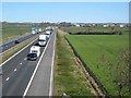

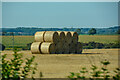

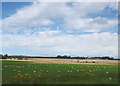
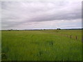
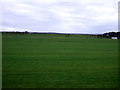
18 photos from this area
Area Information
Key information about the TS21 2ET including its size, population, and administrative classification.
- Area Type
- Postcode
- Area Size
- 1.2 km²
- Population
- 1611
- Population Density
- 20 people/km²
House Prices in TS21 2ET
32
Properties
£198,447
Average Sold Price
£54,000
Lowest Price
£660,000
Highest Price
Showing 32 properties
| Address | Type | Beds | Baths | Last Sale Price | Last Sale Date | |
|---|---|---|---|---|---|---|
| Autumn House, Road Leading To Great Isle, Bradbury, TS21 2ET | house | 4 | 2 | £395,000 | Jan 2025 | |
| Anvil, The Garth, Bradbury, TS21 2ET | Terraced | 3 | 1 | £156,000 | Dec 2022 | |
| 2, The Garth, The Garth, Bradbury, TS21 2ET | house | 3 | - | £135,000 | Sep 2021 | |
| 1 Low Farm, Bradbury, TS21 2ET | Detached | 6 | 3 | £660,000 | Jun 2021 | |
| Ivy Cottage, Road Leading To Great Isle, Bradbury, TS21 2ET | house | - | - | £125,000 | Mar 2018 | |
| Chapel View, Road Leading To Great Isle, Bradbury, TS21 2ET | house | - | - | £176,000 | Dec 2017 | |
| 1, The Garth, The Garth, Bradbury, TS21 2ET | Semi-detached | 3 | 2 | £130,000 | Jul 2017 | |
| Pennywell House, Road Leading To Great Isle, Bradbury, TS21 2ET | Detached | 4 | 2 | £280,000 | Jul 2015 | |
| Blacksmiths Cottage, C 37 From A 689 To The Garth, Bradbury, TS21 2ET | house | - | - | £167,000 | Apr 2014 | |
| Sundown, C 37 From A 689 To The Garth, Bradbury, TS21 2ET | house | - | - | £54,000 | Jan 2014 |
Page 1 of 4
Energy Efficiency in TS21 2ET
Amenities
Schools
| Rank | School | Type | Entry gender | Ages |
|---|
Explore more schools in this area
Go to Schools tabDemographics
Household Size
Two person
most common
Accommodation Type
Houses
most common
Tenure
87
majority
Ethnic Group
White
most common
Religion
N/A
most common
Household Composition
N/A
most common
Age
47
median
Adults (30-64 years)
most common
Household Deprivation
N/A
with no deprivation
NS-SEC
42
in Lower managerial occupations
Explore more demographic insights in this area
Go to Demographics tabPlanning
Planning Constraints
- Flood RiskPremium
- Ramsar Wetland SitesPremium
- Area of Outstanding Natural BeautyPremium
- Protected Nature ReservePremium
- Protected WoodlandPremium