Area Overview for TS20 2SN
Photos of TS20 2SN
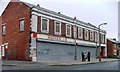
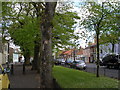
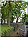
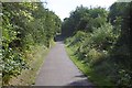


24 photos from this area
Area Information
Key information about the TS20 2SN including its size, population, and administrative classification.
- Area Type
- Postcode
- Area Size
- 1636 m²
- Population
- 1364
- Population Density
- 2023 people/km²
House Prices in TS20 2SN
6
Properties
£99,542
Average Sold Price
£35,000
Lowest Price
£136,250
Highest Price
Showing 6 properties
| Address | Type | Beds | Baths | Last Sale Price | Last Sale Date | |
|---|---|---|---|---|---|---|
| 103 Billingham Road, Norton, TS20 2SN | house | - | - | £125,000 | Aug 2025 | |
| 111 Billingham Road, Norton, TS20 2SN | house | 3 | - | £111,000 | Dec 2012 | |
| 101 Billingham Road, Norton, TS20 2SN | Semi-detached | 3 | 1 | £136,250 | Jun 2007 | |
| 107 Billingham Road, Norton, TS20 2SN | Semi-detached | 3 | 1 | £125,000 | Jun 2006 | |
| 109 Billingham Road, Norton, TS20 2SN | Semi-detached | - | - | £65,000 | Aug 2002 | |
| 105 Billingham Road, Norton, TS20 2SN | Semi-detached | - | - | £35,000 | Mar 2002 |
Energy Efficiency in TS20 2SN
Amenities
Schools
| Rank | School | Type | Entry gender | Ages |
|---|
Explore more schools in this area
Go to Schools tabDemographics
Household Size
One person
most common
Accommodation Type
Houses
most common
Tenure
74
majority
Ethnic Group
White
most common
Religion
N/A
most common
Household Composition
N/A
most common
Age
47
median
Adults (30-64 years)
most common
Household Deprivation
N/A
with no deprivation
NS-SEC
29
in Lower managerial occupations
Explore more demographic insights in this area
Go to Demographics tabPlanning
Planning Constraints
- Flood RiskPremium
- Ramsar Wetland SitesPremium
- Area of Outstanding Natural BeautyPremium
- Protected Nature ReservePremium
- Protected WoodlandPremium