Area Overview for TS20 2QU
Photos of TS20 2QU
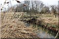
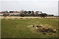
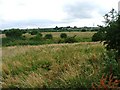
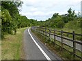
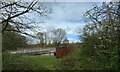
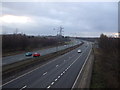
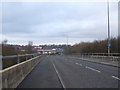
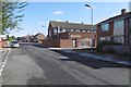

10 photos from this area
Area Information
Key information about the TS20 2QU including its size, population, and administrative classification.
- Area Type
- Postcode
- Area Size
- 4223 m²
- Population
- 1569
- Population Density
- 5726 people/km²
House Prices in TS20 2QU
15
Properties
£77,350
Average Sold Price
£31,000
Lowest Price
£112,500
Highest Price
Showing 15 properties
| Address | Type | Beds | Baths | Last Sale Price | Last Sale Date | |
|---|---|---|---|---|---|---|
| 65 Albany Road, Norton, TS20 2QU | Terraced | 2 | 1 | £80,000 | Mar 2024 | |
| 59 Albany Road, Norton, TS20 2QU | house | - | - | £87,000 | Jun 2020 | |
| 47 Albany Road, Norton, TS20 2QU | Semi-detached | 3 | 1 | £78,500 | Aug 2019 | |
| 41 Albany Road, Norton, TS20 2QU | house | - | - | £109,000 | Feb 2019 | |
| 57 Albany Road, Norton, TS20 2QU | house | 3 | - | £90,000 | Aug 2018 | |
| 61 Albany Road, Norton, TS20 2QU | Semi-detached | 2 | 1 | £62,500 | Jan 2016 | |
| 63 Albany Road, Norton, TS20 2QU | house | - | - | £77,000 | Sep 2015 | |
| 51 Albany Road, Norton, TS20 2QU | Semi-detached | 3 | - | £112,500 | Nov 2014 | |
| 43 Albany Road, Norton, TS20 2QU | Semi-detached | - | - | £46,000 | Oct 2001 | |
| 55 Albany Road, Norton, TS20 2QU | Semi-detached | - | - | £31,000 | Aug 1999 |
Page 1 of 2
Energy Efficiency in TS20 2QU
Amenities
Schools
| Rank | School | Type | Entry gender | Ages |
|---|
Explore more schools in this area
Go to Schools tabDemographics
Household Size
Two person
most common
Accommodation Type
Houses
most common
Tenure
73
majority
Ethnic Group
White
most common
Religion
N/A
most common
Household Composition
N/A
most common
Age
47
median
Adults (30-64 years)
most common
Household Deprivation
N/A
with no deprivation
NS-SEC
27
in Lower managerial occupations
Explore more demographic insights in this area
Go to Demographics tabPlanning
Planning Constraints
- Flood RiskPremium
- Ramsar Wetland SitesPremium
- Area of Outstanding Natural BeautyPremium
- Protected Nature ReservePremium
- Protected WoodlandPremium