Area Overview for TS20 2JT
Photos of TS20 2JT
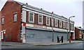
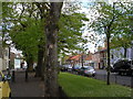
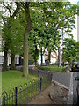
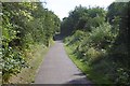

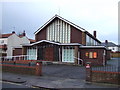
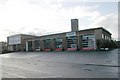
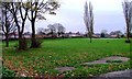
24 photos from this area
Area Information
Key information about the TS20 2JT including its size, population, and administrative classification.
- Area Type
- Postcode
- Area Size
- 4971 m²
- Population
- 1549
- Population Density
- 5564 people/km²
House Prices in TS20 2JT
17
Properties
£76,000
Average Sold Price
£53,500
Lowest Price
£118,000
Highest Price
Showing 17 properties
| Address | Type | Beds | Baths | Last Sale Price | Last Sale Date | |
|---|---|---|---|---|---|---|
| 98 Norton Avenue, Norton, TS20 2JT | Semi-detached | 3 | 1 | £118,000 | Aug 2025 | |
| 108 Norton Avenue, Norton, TS20 2JT | house | 3 | 1 | £87,500 | Mar 2022 | |
| 100 Norton Avenue, Norton, TS20 2JT | Detached | 3 | 1 | £83,000 | Jan 2021 | |
| 110 Norton Avenue, Norton, TS20 2JT | house | 4 | 1 | £61,000 | Aug 2016 | |
| 106 Norton Avenue, Norton, TS20 2JT | house | 3 | - | £63,000 | Dec 2010 | |
| 120 Norton Avenue, Norton, TS20 2JT | house | 3 | - | £53,500 | Aug 2009 | |
| 102 Norton Avenue, Norton, TS20 2JT | Semi-detached | - | - | £65,000 | Jun 2009 | |
| 112 Norton Avenue, Norton, TS20 2JT | house | - | - | £77,000 | Apr 2008 | |
| 1 Alverston Road, Norton, TS20 2JT | undefined | - | - | - | - | |
| 104 Norton Avenue, Norton, TS20 2JT | house | - | - | - | - |
Page 1 of 2
Energy Efficiency in TS20 2JT
Amenities
Schools
| Rank | School | Type | Entry gender | Ages |
|---|
Explore more schools in this area
Go to Schools tabDemographics
Household Size
Family (3-5 people)
most common
Accommodation Type
Houses
most common
Tenure
55
majority
Ethnic Group
White
most common
Religion
N/A
most common
Household Composition
N/A
most common
Age
47
median
Adults (30-64 years)
most common
Household Deprivation
N/A
with no deprivation
NS-SEC
20
in Lower managerial occupations
Explore more demographic insights in this area
Go to Demographics tabPlanning
Planning Constraints
- Flood RiskPremium
- Ramsar Wetland SitesPremium
- Area of Outstanding Natural BeautyPremium
- Protected Nature ReservePremium
- Protected WoodlandPremium