Area Overview for TS20 1TJ
Photos of TS20 1TJ

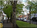
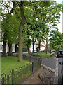

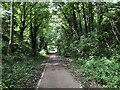
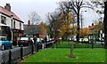
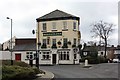
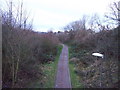


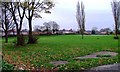
24 photos from this area
Area Information
Key information about the TS20 1TJ including its size, population, and administrative classification.
- Area Type
- Postcode
- Area Size
- 1.2 hectares
- Population
- 1494
- Population Density
- 5000 people/km²
House Prices in TS20 1TJ
32
Properties
£111,525
Average Sold Price
£34,300
Lowest Price
£314,000
Highest Price
Showing 32 properties
| Address | Type | Beds | Baths | Last Sale Price | Last Sale Date | |
|---|---|---|---|---|---|---|
| 9 Mallory Road, Norton, TS20 1TJ | house | - | - | £147,000 | Sep 2025 | |
| 22 Mallory Road, Norton, TS20 1TJ | house | 2 | 1 | £120,000 | Mar 2025 | |
| 2 Mallory Road, Norton, TS20 1TJ | Bungalow | - | - | £240,000 | Jun 2023 | |
| 33 Mallory Road, Norton, TS20 1TJ | Detached | 4 | 2 | £269,950 | Aug 2022 | |
| 27 Mallory Road, Norton, TS20 1TJ | Terraced | 2 | - | £130,000 | Jul 2022 | |
| 25 Mallory Road, Norton, TS20 1TJ | Terraced | 2 | 1 | £115,000 | Oct 2020 | |
| 37 Mallory Road, Norton, TS20 1TJ | house | - | - | £314,000 | May 2020 | |
| 35 Mallory Road, Norton, TS20 1TJ | house | - | - | £310,000 | May 2020 | |
| 16 Mallory Road, Norton, TS20 1TJ | Bungalow | - | - | £232,000 | Oct 2016 | |
| 19 Mallory Road, Norton, TS20 1TJ | Semi-detached | 3 | 2 | £123,000 | Dec 2014 |
Page 1 of 4
Energy Efficiency in TS20 1TJ
Amenities
Schools
| Rank | School | Type | Entry gender | Ages |
|---|
Explore more schools in this area
Go to Schools tabDemographics
Household Size
One person
most common
Accommodation Type
Houses
most common
Tenure
70
majority
Ethnic Group
White
most common
Religion
N/A
most common
Household Composition
N/A
most common
Age
47
median
Adults (30-64 years)
most common
Household Deprivation
N/A
with no deprivation
NS-SEC
26
in Lower managerial occupations
Explore more demographic insights in this area
Go to Demographics tabPlanning
Planning Constraints
- Flood RiskPremium
- Ramsar Wetland SitesPremium
- Area of Outstanding Natural BeautyPremium
- Protected Nature ReservePremium
- Protected WoodlandPremium