Area Overview for TS20 1LS
Photos of TS20 1LS
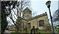
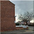
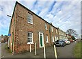
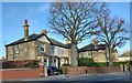
46 photos from this area
Area Information
Key information about the TS20 1LS including its size, population, and administrative classification.
- Area Type
- Postcode
- Area Size
- 1.2 hectares
- Population
- 1494
- Population Density
- 1962 people/km²
House Prices in TS20 1LS
24
Properties
£195,045
Average Sold Price
£80,000
Lowest Price
£416,000
Highest Price
Showing 24 properties
| Address | Type | Beds | Baths | Last Sale Price | Last Sale Date | |
|---|---|---|---|---|---|---|
| 23 Falcon Lane, Norton, TS20 1LS | Detached | 4 | 1 | £308,000 | Nov 2022 | |
| 2 Falcon Lane, Norton, TS20 1LS | house | - | - | £416,000 | Aug 2021 | |
| 11 Falcon Lane, Norton, TS20 1LS | house | 5 | - | £210,000 | Feb 2011 | |
| 4 Falcon Lane, Norton, TS20 1LS | Detached | - | - | £240,000 | May 2006 | |
| 15 Falcon Lane, Norton, TS20 1LS | Detached | - | - | £190,000 | May 2006 | |
| 18 Falcon Lane, Norton, TS20 1LS | Detached | - | - | £193,500 | Feb 2006 | |
| 25 Falcon Lane, Norton, TS20 1LS | Detached | - | - | £197,000 | Sep 2005 | |
| 8 Falcon Lane, Norton, TS20 1LS | Detached | - | - | £127,000 | Oct 2002 | |
| 22 Falcon Lane, Norton, TS20 1LS | Detached | - | - | £95,000 | Mar 2002 | |
| 19 Falcon Lane, Norton, TS20 1LS | Detached | - | - | £89,000 | Sep 2000 |
Page 1 of 3
Energy Efficiency in TS20 1LS
Amenities
Schools
| Rank | School | Type | Entry gender | Ages |
|---|
Explore more schools in this area
Go to Schools tabDemographics
Household Size
Two person
most common
Accommodation Type
Houses
most common
Tenure
91
majority
Ethnic Group
White
most common
Religion
N/A
most common
Household Composition
N/A
most common
Age
47
median
Adults (30-64 years)
most common
Household Deprivation
N/A
with no deprivation
NS-SEC
42
in Lower managerial occupations
Explore more demographic insights in this area
Go to Demographics tabPlanning
Planning Constraints
- Flood RiskPremium
- Ramsar Wetland SitesPremium
- Area of Outstanding Natural BeautyPremium
- Protected Nature ReservePremium
- Protected WoodlandPremium