Area Overview for TS19 0QA
Photos of TS19 0QA
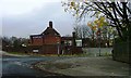
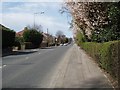

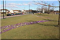
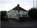


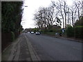
9 photos from this area
Area Information
Key information about the TS19 0QA including its size, population, and administrative classification.
- Area Type
- Postcode
- Area Size
- 1.6 hectares
- Population
- 1251
- Population Density
- 2726 people/km²
House Prices in TS19 0QA
19
Properties
£172,518
Average Sold Price
£47,000
Lowest Price
£345,000
Highest Price
Showing 19 properties
| Address | Type | Beds | Baths | Last Sale Price | Last Sale Date | |
|---|---|---|---|---|---|---|
| 205 Durham Road, Stockton On Tees, TS19 0QA | house | 3 | 2 | £345,000 | Jul 2021 | |
| 201 Durham Road, Stockton On Tees, TS19 0QA | house | - | - | £193,000 | Jun 2020 | |
| 197 Durham Road, Stockton On Tees, TS19 0QA | Semi-detached | 4 | - | £195,500 | Mar 2017 | |
| 221 Durham Road, Stockton On Tees, TS19 0QA | house | 4 | - | £255,000 | Feb 2016 | |
| 207 Durham Road, Stockton On Tees, TS19 0QA | house | 3 | 2 | £185,000 | Aug 2011 | |
| 191 Durham Road, Stockton On Tees, TS19 0QA | Semi-detached | 4 | 1 | £165,000 | Sep 2009 | |
| 215 Durham Road, Stockton On Tees, TS19 0QA | Semi-detached | 3 | 1 | £132,200 | Mar 2004 | |
| 219 Durham Road, Stockton On Tees, TS19 0QA | Detached | 1 | 2 | £125,000 | Mar 2002 | |
| 199 Durham Road, Stockton On Tees, TS19 0QA | Detached | - | - | £120,000 | Dec 2001 | |
| 219A Durham Road, Stockton On Tees, TS19 0QA | house | - | - | £135,000 | Sep 2000 |
Page 1 of 2
Energy Efficiency in TS19 0QA
Amenities
Schools
| Rank | School | Type | Entry gender | Ages |
|---|
Explore more schools in this area
Go to Schools tabDemographics
Household Size
One person
most common
Accommodation Type
Houses
most common
Tenure
52
majority
Ethnic Group
White
most common
Religion
N/A
most common
Household Composition
N/A
most common
Age
47
median
Adults (30-64 years)
most common
Household Deprivation
N/A
with no deprivation
NS-SEC
20
in Lower managerial occupations
Explore more demographic insights in this area
Go to Demographics tabPlanning
Planning Constraints
- Flood RiskPremium
- Ramsar Wetland SitesPremium
- Area of Outstanding Natural BeautyPremium
- Protected Nature ReservePremium
- Protected WoodlandPremium