Area Overview for TS19 0NG
Photos of TS19 0NG


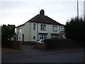


9 photos from this area
Area Information
Key information about the TS19 0NG including its size, population, and administrative classification.
- Area Type
- Postcode
- Area Size
- 4741 m²
- Population
- 1042
- Population Density
- 4941 people/km²
House Prices in TS19 0NG
13
Properties
£95,083
Average Sold Price
£47,000
Lowest Price
£139,000
Highest Price
Showing 13 properties
| Address | Type | Beds | Baths | Last Sale Price | Last Sale Date | |
|---|---|---|---|---|---|---|
| 138 Darlington Lane, Stockton On Tees, TS19 0NG | Semi-detached | 3 | 1 | £127,800 | Apr 2024 | |
| 142 Darlington Lane, Stockton On Tees, TS19 0NG | Semi-detached | 3 | 1 | £139,000 | Jul 2021 | |
| 130 Darlington Lane, Stockton On Tees, TS19 0NG | Semi-detached | 3 | 1 | £90,000 | Jul 2020 | |
| 150 Darlington Lane, Stockton On Tees, TS19 0NG | Semi-detached | 3 | 2 | £126,500 | Jun 2019 | |
| 140 Darlington Lane, Stockton On Tees, TS19 0NG | house | - | - | £120,000 | Jul 2012 | |
| 128 Darlington Lane, Stockton On Tees, TS19 0NG | house | - | - | £92,000 | Oct 2003 | |
| 132 Darlington Lane, Stockton On Tees, TS19 0NG | Semi-detached | - | - | £53,500 | May 2002 | |
| 152 Darlington Lane, Stockton On Tees, TS19 0NG | Semi-detached | 2 | 1 | £59,950 | Apr 2002 | |
| 134 Darlington Lane, Stockton On Tees, TS19 0NG | Semi-detached | - | - | £47,000 | Mar 1997 | |
| 148 Darlington Lane, Stockton On Tees, TS19 0NG | Semi-detached | 3 | - | - | - |
Page 1 of 2
Energy Efficiency in TS19 0NG
Amenities
Schools
| Rank | School | Type | Entry gender | Ages |
|---|
Explore more schools in this area
Go to Schools tabDemographics
Household Size
Two person
most common
Accommodation Type
Houses
most common
Tenure
86
majority
Ethnic Group
White
most common
Religion
N/A
most common
Household Composition
N/A
most common
Age
47
median
Adults (30-64 years)
most common
Household Deprivation
N/A
with no deprivation
NS-SEC
26
in Lower managerial occupations
Explore more demographic insights in this area
Go to Demographics tabPlanning
Planning Constraints
- Flood RiskPremium
- Ramsar Wetland SitesPremium
- Area of Outstanding Natural BeautyPremium
- Protected Nature ReservePremium
- Protected WoodlandPremium