Area Overview for TS18 5EB
Photos of TS18 5EB
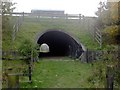
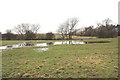
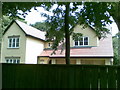
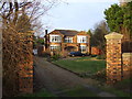
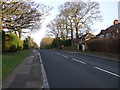
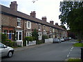
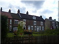
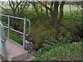
8 photos from this area
Area Information
Key information about the TS18 5EB including its size, population, and administrative classification.
- Area Type
- Postcode
- Area Size
- 8856 m²
- Population
- 1502
- Population Density
- 982 people/km²
House Prices in TS18 5EB
21
Properties
£210,792
Average Sold Price
£108,000
Lowest Price
£320,000
Highest Price
Showing 21 properties
| Address | Type | Beds | Baths | Last Sale Price | Last Sale Date | |
|---|---|---|---|---|---|---|
| 34 Hartburn Village, Stockton On Tees, TS18 5EB | Terraced | 4 | 1 | £320,000 | Dec 2024 | |
| 40 Hartburn Village, Stockton On Tees, TS18 5EB | Terraced | 3 | 1 | £312,500 | Apr 2024 | |
| 26 Hartburn Village, Stockton On Tees, TS18 5EB | Terraced | 4 | 3 | £310,000 | Aug 2021 | |
| 30 Hartburn Village, Stockton On Tees, TS18 5EB | house | - | - | £250,000 | Feb 2021 | |
| 12 Hartburn Village, Stockton On Tees, TS18 5EB | house | - | - | £155,000 | Apr 2017 | |
| 20 Hartburn Village, Stockton On Tees, TS18 5EB | house | 3 | - | £250,000 | Nov 2011 | |
| Primrose Cottage, Hartburn Village, Stockton On Tees, TS18 5EB | Detached | 3 | 2 | £245,000 | Jun 2007 | |
| 8 Hartburn Village, Stockton On Tees, TS18 5EB | house | 2 | - | £145,000 | Dec 2005 | |
| 28 Hartburn Village, Stockton On Tees, TS18 5EB | Terraced | - | - | £129,000 | May 2002 | |
| 36 Hartburn Village, Stockton On Tees, TS18 5EB | Terraced | - | - | £108,000 | Jan 2002 |
Page 1 of 3
Energy Efficiency in TS18 5EB
Amenities
Schools
| Rank | School | Type | Entry gender | Ages |
|---|
Explore more schools in this area
Go to Schools tabDemographics
Household Size
Two person
most common
Accommodation Type
Houses
most common
Tenure
91
majority
Ethnic Group
White
most common
Religion
N/A
most common
Household Composition
N/A
most common
Age
47
median
Adults (30-64 years)
most common
Household Deprivation
N/A
with no deprivation
NS-SEC
42
in Lower managerial occupations
Explore more demographic insights in this area
Go to Demographics tabPlanning
Planning Constraints
- Flood RiskPremium
- Ramsar Wetland SitesPremium
- Area of Outstanding Natural BeautyPremium
- Protected Nature ReservePremium
- Protected WoodlandPremium