Area Overview for TS18 3HF
Photos of TS18 3HF
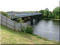
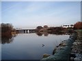
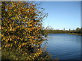
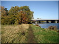
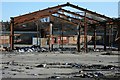

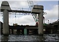
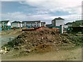
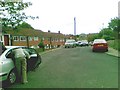
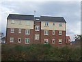

15 photos from this area
Area Information
Key information about the TS18 3HF including its size, population, and administrative classification.
- Area Type
- Postcode
- Area Size
- 6.1 hectares
- Population
- 1957
- Population Density
- 588 people/km²
House Prices in TS18 3HF
27
Properties
-
Average Sold Price
-
Lowest Price
-
Highest Price
Showing 27 properties
| Address | Type | Beds | Baths | Last Sale Price | Last Sale Date | |
|---|---|---|---|---|---|---|
| L J J Limited, 107 Bowesfield Lane, Stockton On Tees, TS18 3HF | office_workshop | - | - | - | - | |
| C P D Bodies Limited, Unit 11, Berryvale, Bowesfield Crescent, Stockton On Tees, TS18 3HF | office_workshop | - | - | - | - | |
| Flat 1, 97 Bowesfield Lane, Stockton On Tees, TS18 3HF | Flat | - | - | - | - | |
| Flat 2, 97 Bowesfield Lane, Stockton On Tees, TS18 3HF | Flat | - | - | - | - | |
| Dents Accident Repair Centre, Unit 12, Berryvale, Bowesfield Crescent, Stockton On Tees, TS18 3HF | Industrial | - | - | - | - | |
| Unit 2, 109 Bowesfield Lane, Stockton On Tees, TS18 3HF | warehouse | - | - | - | - | |
| Doocey North East, Bowesfield Lane, Stockton On Tees, TS18 3HF | Industrial | - | - | - | - | |
| Site Of Plot 3, Caravan Site, Bowesfield Lane, Stockton On Tees, TS18 3HF | Mobile Home | - | - | - | - | |
| Site Of Plot 2, Caravan Site, Bowesfield Lane, Stockton On Tees, TS18 3HF | Mobile Home | - | - | - | - | |
| Plot 29, Former Caravan Site, Bowesfield Lane, Stockton On Tees, TS18 3HF | Mobile Home | - | - | - | - |
Page 1 of 3
Energy Efficiency in TS18 3HF
Amenities
Schools
| Rank | School | Type | Entry gender | Ages |
|---|
Explore more schools in this area
Go to Schools tabDemographics
Household Size
Family (3-5 people)
most common
Accommodation Type
Houses
most common
Tenure
51
majority
Ethnic Group
White
most common
Religion
N/A
most common
Household Composition
N/A
most common
Age
47
median
Adults (30-64 years)
most common
Household Deprivation
N/A
with no deprivation
NS-SEC
28
in Lower managerial occupations
Explore more demographic insights in this area
Go to Demographics tabPlanning
Planning Constraints
- Flood RiskPremium
- Ramsar Wetland SitesPremium
- Area of Outstanding Natural BeautyPremium
- Protected Nature ReservePremium
- Protected WoodlandPremium