Area Overview for TS17 9DW
Photos of TS17 9DW
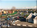
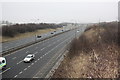
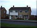
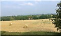
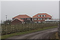
5 photos from this area
Area Information
Key information about the TS17 9DW including its size, population, and administrative classification.
- Area Type
- Postcode
- Area Size
- 1.3 hectares
- Population
- 1416
- Population Density
- 3375 people/km²
House Prices in TS17 9DW
30
Properties
£104,328
Average Sold Price
£42,000
Lowest Price
£162,000
Highest Price
Showing 30 properties
| Address | Type | Beds | Baths | Last Sale Price | Last Sale Date | |
|---|---|---|---|---|---|---|
| 16 Wolsingham Drive, Thornaby, TS17 9DW | house | - | - | £85,000 | Aug 2024 | |
| 29 Wolsingham Drive, Thornaby, TS17 9DW | Bungalow | 2 | 1 | £136,000 | Jul 2024 | |
| 35 Wolsingham Drive, Thornaby, TS17 9DW | Semi-detached | 2 | 1 | £150,000 | Apr 2023 | |
| 33 Wolsingham Drive, Thornaby, TS17 9DW | Bungalow | - | - | £162,000 | Apr 2023 | |
| 41 Wolsingham Drive, Thornaby, TS17 9DW | Bungalow | - | - | £135,000 | Jul 2021 | |
| 27 Wolsingham Drive, Thornaby, TS17 9DW | Bungalow | 2 | 1 | £123,000 | Feb 2021 | |
| 18 Wolsingham Drive, Thornaby, TS17 9DW | Semi-detached | 3 | 1 | £130,000 | Sep 2020 | |
| 10 Wolsingham Drive, Thornaby, TS17 9DW | house | - | - | £125,000 | Sep 2020 | |
| 37 Wolsingham Drive, Thornaby, TS17 9DW | Semi-detached | 2 | 1 | £114,950 | Dec 2018 | |
| 7 Wolsingham Drive, Thornaby, TS17 9DW | Semi-detached | 3 | 1 | £139,950 | Oct 2018 |
Page 1 of 3
Energy Efficiency in TS17 9DW
Amenities
Schools
| Rank | School | Type | Entry gender | Ages |
|---|
Explore more schools in this area
Go to Schools tabDemographics
Household Size
Two person
most common
Accommodation Type
Houses
most common
Tenure
85
majority
Ethnic Group
White
most common
Religion
N/A
most common
Household Composition
N/A
most common
Age
47
median
Adults (30-64 years)
most common
Household Deprivation
N/A
with no deprivation
NS-SEC
24
in Lower managerial occupations
Explore more demographic insights in this area
Go to Demographics tabPlanning
Planning Constraints
- Flood RiskPremium
- Ramsar Wetland SitesPremium
- Area of Outstanding Natural BeautyPremium
- Protected Nature ReservePremium
- Protected WoodlandPremium