Area Overview for TS17 5GB
Photos of TS17 5GB
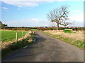
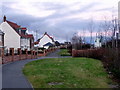
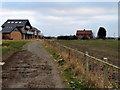
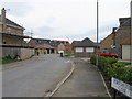
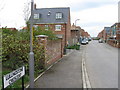
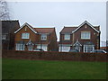

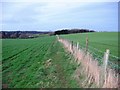
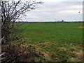
11 photos from this area
Area Information
Key information about the TS17 5GB including its size, population, and administrative classification.
- Area Type
- Postcode
- Area Size
- 3.9 hectares
- Population
- 1906
- Population Density
- 3418 people/km²
House Prices in TS17 5GB
93
Properties
£216,295
Average Sold Price
£119,950
Lowest Price
£393,750
Highest Price
Showing 93 properties
| Address | Type | Beds | Baths | Last Sale Price | Last Sale Date | |
|---|---|---|---|---|---|---|
| 87 Apsley Way, Ingleby Barwick, TS17 5GB | house | - | - | £355,000 | Mar 2025 | |
| 15 Apsley Way, Ingleby Barwick, TS17 5GB | house | 5 | 3 | £393,750 | Feb 2025 | |
| 91 Apsley Way, Ingleby Barwick, TS17 5GB | house | - | - | £350,000 | Aug 2024 | |
| 85 Apsley Way, Ingleby Barwick, TS17 5GB | Detached | 5 | 3 | £320,000 | Aug 2023 | |
| 21 Apsley Way, Ingleby Barwick, TS17 5GB | house | 4 | 2 | £245,000 | Jun 2023 | |
| 111 Apsley Way, Ingleby Barwick, TS17 5GB | Detached | 4 | 3 | £256,000 | Mar 2023 | |
| 11 Apsley Way, Ingleby Barwick, TS17 5GB | Detached | 5 | 3 | £375,000 | Nov 2022 | |
| 141 Apsley Way, Ingleby Barwick, TS17 5GB | Semi-detached | 3 | - | £185,000 | Aug 2022 | |
| 157 Apsley Way, Ingleby Barwick, TS17 5GB | house | - | - | £201,000 | Aug 2022 | |
| 143 Apsley Way, Ingleby Barwick, TS17 5GB | house | - | - | £165,000 | Jun 2021 |
Page 1 of 10
Energy Efficiency in TS17 5GB
Amenities
Schools
| Rank | School | Type | Entry gender | Ages |
|---|
Explore more schools in this area
Go to Schools tabDemographics
Household Size
Family (3-5 people)
most common
Accommodation Type
Houses
most common
Tenure
86
majority
Ethnic Group
White
most common
Religion
N/A
most common
Household Composition
N/A
most common
Age
47
median
Adults (30-64 years)
most common
Household Deprivation
N/A
with no deprivation
NS-SEC
49
in Lower managerial occupations
Explore more demographic insights in this area
Go to Demographics tabPlanning
Planning Constraints
- Flood RiskPremium
- Ramsar Wetland SitesPremium
- Area of Outstanding Natural BeautyPremium
- Protected Nature ReservePremium
- Protected WoodlandPremium