Area Overview for TS17 0RA
Photos of TS17 0RA
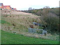
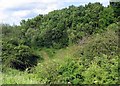
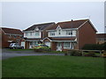
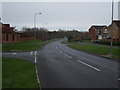
6 photos from this area
Area Information
Key information about the TS17 0RA including its size, population, and administrative classification.
- Area Type
- Postcode
- Area Size
- 5102 m²
- Population
- 1236
- Population Density
- 2582 people/km²
House Prices in TS17 0RA
8
Properties
£135,556
Average Sold Price
£79,950
Lowest Price
£213,000
Highest Price
Showing 8 properties
| Address | Type | Beds | Baths | Last Sale Price | Last Sale Date | |
|---|---|---|---|---|---|---|
| 7 Lowfields Green, Ingleby Barwick, TS17 0RA | house | 3 | - | £120,000 | Jan 2021 | |
| 6 Lowfields Green, Ingleby Barwick, TS17 0RA | Semi-detached | 3 | 1 | £123,000 | May 2018 | |
| 1 Lowfields Green, Ingleby Barwick, TS17 0RA | Detached | 4 | 2 | £213,000 | Oct 2014 | |
| 5 Lowfields Green, Ingleby Barwick, TS17 0RA | house | - | - | £115,000 | Apr 2012 | |
| 8 Lowfields Green, Ingleby Barwick, TS17 0RA | house | - | - | £120,000 | Feb 2010 | |
| 2 Lowfields Green, Ingleby Barwick, TS17 0RA | Detached | - | - | £197,500 | May 2007 | |
| 3 Lowfields Green, Ingleby Barwick, TS17 0RA | Detached | 4 | 2 | £116,000 | Jul 2002 | |
| 4 Lowfields Green, Ingleby Barwick, TS17 0RA | Detached | - | - | £79,950 | Aug 1999 |
Energy Efficiency in TS17 0RA
Amenities
Schools
| Rank | School | Type | Entry gender | Ages |
|---|
Explore more schools in this area
Go to Schools tabDemographics
Household Size
Two person
most common
Accommodation Type
Houses
most common
Tenure
82
majority
Ethnic Group
White
most common
Religion
N/A
most common
Household Composition
N/A
most common
Age
47
median
Adults (30-64 years)
most common
Household Deprivation
N/A
with no deprivation
NS-SEC
39
in Lower managerial occupations
Explore more demographic insights in this area
Go to Demographics tabPlanning
Planning Constraints
- Flood RiskPremium
- Ramsar Wetland SitesPremium
- Area of Outstanding Natural BeautyPremium
- Protected Nature ReservePremium
- Protected WoodlandPremium