Area Overview for TS16 0NG
Photos of TS16 0NG
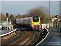
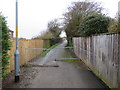
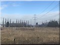
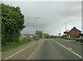
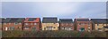
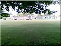
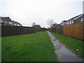
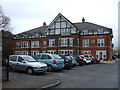
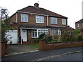
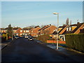
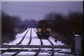
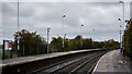
14 photos from this area
Area Information
Key information about the TS16 0NG including its size, population, and administrative classification.
- Area Type
- Postcode
- Area Size
- 1.3 hectares
- Population
- 2112
- Population Density
- 2188 people/km²
House Prices in TS16 0NG
16
Properties
£130,935
Average Sold Price
£56,000
Lowest Price
£350,000
Highest Price
Showing 16 properties
| Address | Type | Beds | Baths | Last Sale Price | Last Sale Date | |
|---|---|---|---|---|---|---|
| 21 Amberley Way, Eaglescliffe, TS16 0NG | Detached | 4 | 2 | £350,000 | Nov 2022 | |
| 23 Amberley Way, Eaglescliffe, TS16 0NG | Bungalow | - | - | £153,250 | Jul 2020 | |
| 5 Amberley Way, Eaglescliffe, TS16 0NG | house | - | - | £150,000 | Mar 2020 | |
| 17 Amberley Way, Eaglescliffe, TS16 0NG | Semi-detached | 2 | 1 | £167,000 | Mar 2020 | |
| 13 Amberley Way, Eaglescliffe, TS16 0NG | Bungalow | - | - | £122,500 | Jan 2016 | |
| 19 Amberley Way, Eaglescliffe, TS16 0NG | Bungalow | - | - | £129,950 | Dec 2015 | |
| 7 Amberley Way, Eaglescliffe, TS16 0NG | Semi-detached | 3 | - | £137,000 | Oct 2015 | |
| 15 Amberley Way, Eaglescliffe, TS16 0NG | Semi-detached | 3 | - | £110,000 | Aug 2015 | |
| 29 Amberley Way, Eaglescliffe, TS16 0NG | Bungalow | - | - | £139,950 | Feb 2007 | |
| 11 Amberley Way, Eaglescliffe, TS16 0NG | Semi-detached | - | - | £65,000 | May 2002 |
Page 1 of 2
Energy Efficiency in TS16 0NG
Amenities
Schools
| Rank | School | Type | Entry gender | Ages |
|---|
Explore more schools in this area
Go to Schools tabDemographics
Household Size
Two person
most common
Accommodation Type
Houses
most common
Tenure
89
majority
Ethnic Group
White
most common
Religion
N/A
most common
Household Composition
N/A
most common
Age
47
median
Adults (30-64 years)
most common
Household Deprivation
N/A
with no deprivation
NS-SEC
38
in Lower managerial occupations
Explore more demographic insights in this area
Go to Demographics tabPlanning
Planning Constraints
- Flood RiskPremium
- Ramsar Wetland SitesPremium
- Area of Outstanding Natural BeautyPremium
- Protected Nature ReservePremium
- Protected WoodlandPremium