Area Overview for TS14 7LW
Photos of TS14 7LW
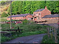
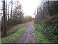
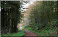
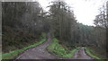
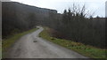
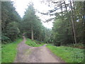
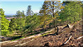
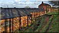
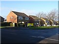
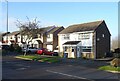
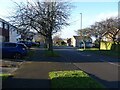
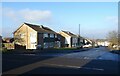
36 photos from this area
Area Information
Key information about the TS14 7LW including its size, population, and administrative classification.
- Area Type
- Postcode
- Area Size
- 1.4 hectares
- Population
- 1443
- Population Density
- 607 people/km²
House Prices in TS14 7LW
21
Properties
£145,518
Average Sold Price
£49,000
Lowest Price
£225,000
Highest Price
Showing 21 properties
| Address | Type | Beds | Baths | Last Sale Price | Last Sale Date | |
|---|---|---|---|---|---|---|
| 7 Portman Rise, Guisborough, TS14 7LW | Semi-detached | 3 | 1 | £225,000 | Dec 2024 | |
| 4 Portman Rise, Guisborough, TS14 7LW | house | - | - | £210,000 | Aug 2021 | |
| 9 Portman Rise, Guisborough, TS14 7LW | Semi-detached | 3 | 1 | £149,950 | Sep 2020 | |
| 13 Portman Rise, Guisborough, TS14 7LW | house | - | - | £154,000 | May 2019 | |
| 2 Portman Rise, Guisborough, TS14 7LW | Semi-detached | 3 | 1 | £148,000 | Dec 2018 | |
| 5 Portman Rise, Guisborough, TS14 7LW | house | - | - | £140,000 | Oct 2015 | |
| 18 Portman Rise, Guisborough, TS14 7LW | house | - | - | £157,000 | Mar 2014 | |
| 16 Portman Rise, Guisborough, TS14 7LW | house | - | - | £158,750 | Feb 2010 | |
| 20 Portman Rise, Guisborough, TS14 7LW | Semi-detached | 3 | 1 | £143,000 | Sep 2005 | |
| 10 Portman Rise, Guisborough, TS14 7LW | Semi-detached | - | - | £66,000 | Oct 2000 |
Page 1 of 3
Energy Efficiency in TS14 7LW
Amenities
Schools
| Rank | School | Type | Entry gender | Ages |
|---|
Explore more schools in this area
Go to Schools tabDemographics
Household Size
Two person
most common
Accommodation Type
Houses
most common
Tenure
87
majority
Ethnic Group
White
most common
Religion
N/A
most common
Household Composition
N/A
most common
Age
47
median
Adults (30-64 years)
most common
Household Deprivation
N/A
with no deprivation
NS-SEC
34
in Lower managerial occupations
Explore more demographic insights in this area
Go to Demographics tabPlanning
Planning Constraints
- Flood RiskPremium
- Ramsar Wetland SitesPremium
- Area of Outstanding Natural BeautyPremium
- Protected Nature ReservePremium
- Protected WoodlandPremium