Area Overview for TS14 6NL
Photos of TS14 6NL
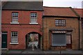
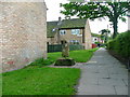

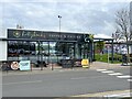
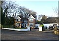
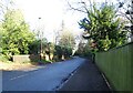
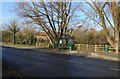
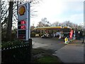
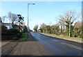
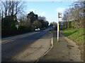
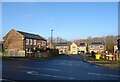
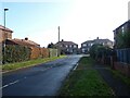
31 photos from this area
Area Information
Key information about the TS14 6NL including its size, population, and administrative classification.
- Area Type
- Postcode
- Area Size
- 4402 m²
- Population
- 1345
- Population Density
- 8127 people/km²
House Prices in TS14 6NL
16
Properties
£116,938
Average Sold Price
£44,500
Lowest Price
£182,500
Highest Price
Showing 16 properties
| Address | Type | Beds | Baths | Last Sale Price | Last Sale Date | |
|---|---|---|---|---|---|---|
| 178 Westgate, Guisborough, TS14 6NL | Bungalow | 2 | 1 | £182,500 | May 2025 | |
| 158 Westgate, Guisborough, TS14 6NL | Terraced | 3 | 1 | £142,500 | Mar 2025 | |
| 162 Westgate, Guisborough, TS14 6NL | house | - | - | £75,000 | Oct 2022 | |
| 168 Westgate, Guisborough, TS14 6NL | Semi-detached | 4 | 1 | £122,500 | Apr 2018 | |
| 172 Westgate, Guisborough, TS14 6NL | Semi-detached | 3 | 1 | £168,000 | Mar 2007 | |
| 180 Westgate, Guisborough, TS14 6NL | Detached | - | - | £127,000 | Apr 2002 | |
| 170 Westgate, Guisborough, TS14 6NL | Semi-detached | 4 | 1 | £73,500 | Aug 2001 | |
| 160 Westgate, Guisborough, TS14 6NL | Terraced | - | - | £44,500 | Sep 2000 | |
| 164 Westgate, Guisborough, TS14 6NL | Terraced | 3 | 1 | - | - | |
| Ground Floor Flat, 156 Westgate, Guisborough, TS14 6NL | Terraced | 3 | - | - | - |
Page 1 of 2
Energy Efficiency in TS14 6NL
Amenities
Schools
| Rank | School | Type | Entry gender | Ages |
|---|
Explore more schools in this area
Go to Schools tabDemographics
Household Size
One person
most common
Accommodation Type
Houses
most common
Tenure
65
majority
Ethnic Group
White
most common
Religion
N/A
most common
Household Composition
N/A
most common
Age
47
median
Adults (30-64 years)
most common
Household Deprivation
N/A
with no deprivation
NS-SEC
22
in Lower managerial occupations
Explore more demographic insights in this area
Go to Demographics tabPlanning
Planning Constraints
- Flood RiskPremium
- Ramsar Wetland SitesPremium
- Area of Outstanding Natural BeautyPremium
- Protected Nature ReservePremium
- Protected WoodlandPremium