Area Overview for TS13 5DT
Photos of TS13 5DT
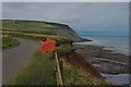
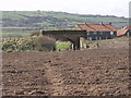
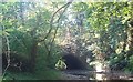

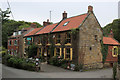
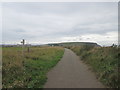
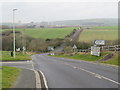
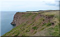
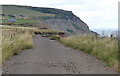
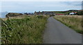
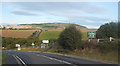
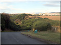
63 photos from this area
Area Information
Key information about the TS13 5DT including its size, population, and administrative classification.
- Area Type
- Postcode
- Area Size
- 40.8 hectares
- Population
- 1357
- Population Density
- 100 people/km²
House Prices in TS13 5DT
24
Properties
£278,500
Average Sold Price
£51,000
Lowest Price
£760,000
Highest Price
Showing 24 properties
| Address | Type | Beds | Baths | Last Sale Price | Last Sale Date | |
|---|---|---|---|---|---|---|
| The Old Mill, Dalehouse Bank To Dalehouse Bridge, Dalehouse, Staithes, TS13 5DT | Detached | 6 | 6 | £760,000 | Feb 2023 | |
| 9 Roxby Lane, Dalehouse, Staithes, TS13 5DT | house | - | - | £150,000 | Jul 2019 | |
| Wildthorns, Roxby Lane, Dalehouse, Staithes, TS13 5DT | house | - | - | £495,000 | Dec 2018 | |
| 7 Roxby Lane, Dalehouse, Staithes, TS13 5DT | house | - | - | £175,000 | Nov 2014 | |
| Glendale, 6 Roxby Lane, Dalehouse, Staithes, TS13 5DT | Terraced | 6 | - | £156,000 | Sep 2012 | |
| 11 Roxby Lane, Dalehouse, Staithes, TS13 5DT | house | 2 | - | £145,000 | Jan 2012 | |
| 5 Roxby Lane, Dalehouse, Staithes, TS13 5DT | house | - | - | £296,000 | Feb 2010 | |
| 21 Roxby Lane, Dalehouse, Staithes, TS13 5DT | Terraced | - | - | £51,000 | Jun 1995 | |
| Glendale, Dalehouse, Staithes, TS13 5DT | undefined | - | - | - | - | |
| 2 Dalehouse, Staithes, TS13 5DT | Retail | 6 | 6 | - | - |
Page 1 of 3
Energy Efficiency in TS13 5DT
Amenities
Schools
| Rank | School | Type | Entry gender | Ages |
|---|
Explore more schools in this area
Go to Schools tabDemographics
Household Size
Two person
most common
Accommodation Type
Houses
most common
Tenure
59
majority
Ethnic Group
White
most common
Religion
N/A
most common
Household Composition
N/A
most common
Age
47
median
Adults (30-64 years)
most common
Household Deprivation
N/A
with no deprivation
NS-SEC
20
in Lower managerial occupations
Explore more demographic insights in this area
Go to Demographics tabPlanning
Planning Constraints
- Flood RiskPremium
- Ramsar Wetland SitesPremium
- Area of Outstanding Natural BeautyPremium
- Protected Nature ReservePremium
- Protected WoodlandPremium