Area Overview for TS12 2XH
Photos of TS12 2XH

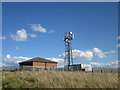
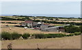

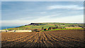
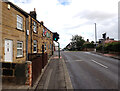
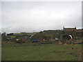
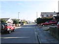
23 photos from this area
Area Information
Key information about the TS12 2XH including its size, population, and administrative classification.
- Area Type
- Postcode
- Area Size
- 1.1 hectares
- Population
- 1572
- Population Density
- 1203 people/km²
House Prices in TS12 2XH
32
Properties
£91,907
Average Sold Price
£19,000
Lowest Price
£178,500
Highest Price
Showing 32 properties
| Address | Type | Beds | Baths | Last Sale Price | Last Sale Date | |
|---|---|---|---|---|---|---|
| 5 Conyers Court, Brotton, TS12 2XH | Semi-detached | 3 | 1 | £170,000 | Aug 2023 | |
| 39 Conyers Court, Brotton, TS12 2XH | Semi-detached | 2 | 1 | £146,500 | Jul 2022 | |
| 7 Conyers Court, Brotton, TS12 2XH | Semi-detached | 3 | 1 | £145,000 | Nov 2020 | |
| 22 Conyers Court, Brotton, TS12 2XH | Semi-detached | 3 | 2 | £102,000 | Mar 2019 | |
| 16 Conyers Court, Brotton, TS12 2XH | Semi-detached | 2 | 1 | £76,000 | Aug 2018 | |
| 27 Conyers Court, Brotton, TS12 2XH | house | - | - | £84,995 | Feb 2018 | |
| 10 Conyers Court, Brotton, TS12 2XH | Semi-detached | 2 | 1 | £99,000 | Aug 2016 | |
| 9 Conyers Court, Brotton, TS12 2XH | house | 3 | 1 | £140,000 | Jul 2016 | |
| 15 Conyers Court, Brotton, TS12 2XH | Semi-detached | 3 | 1 | £145,000 | Sep 2015 | |
| 25 Conyers Court, Brotton, TS12 2XH | Semi-detached | 2 | 1 | £104,000 | Jan 2015 |
Page 1 of 4
Energy Efficiency in TS12 2XH
Amenities
Schools
| Rank | School | Type | Entry gender | Ages |
|---|
Explore more schools in this area
Go to Schools tabDemographics
Household Size
Two person
most common
Accommodation Type
Houses
most common
Tenure
74
majority
Ethnic Group
White
most common
Religion
N/A
most common
Household Composition
N/A
most common
Age
47
median
Adults (30-64 years)
most common
Household Deprivation
N/A
with no deprivation
NS-SEC
23
in Lower managerial occupations
Explore more demographic insights in this area
Go to Demographics tabPlanning
Planning Constraints
- Flood RiskPremium
- Ramsar Wetland SitesPremium
- Area of Outstanding Natural BeautyPremium
- Protected Nature ReservePremium
- Protected WoodlandPremium