Area Overview for TS12 2QH
Photos of TS12 2QH
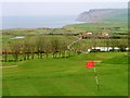
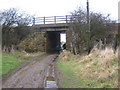
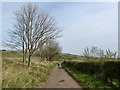
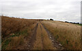
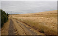
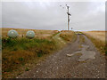
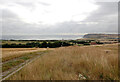
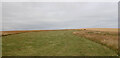

18 photos from this area
Area Information
Key information about the TS12 2QH including its size, population, and administrative classification.
- Area Type
- Postcode
- Area Size
- 5.6 hectares
- Population
- 1222
- Population Density
- 236 people/km²
House Prices in TS12 2QH
47
Properties
£175,486
Average Sold Price
£105,000
Lowest Price
£237,500
Highest Price
Showing 47 properties
| Address | Type | Beds | Baths | Last Sale Price | Last Sale Date | |
|---|---|---|---|---|---|---|
| 29 The Forge, Brotton, TS12 2QH | house | - | - | £237,500 | Dec 2022 | |
| 14 The Forge, Brotton, TS12 2QH | Semi-detached | 3 | 1 | £137,500 | Nov 2021 | |
| 43 The Forge, Brotton, TS12 2QH | house | - | - | £175,000 | Apr 2021 | |
| 22 The Forge, Brotton, TS12 2QH | house | - | - | £174,950 | Nov 2020 | |
| 24 The Forge, Brotton, TS12 2QH | Detached | 4 | 1 | £189,500 | Nov 2020 | |
| 45 The Forge, Brotton, TS12 2QH | house | - | - | £163,000 | Oct 2020 | |
| 38 The Forge, Brotton, TS12 2QH | Bungalow | - | - | £165,000 | Sep 2019 | |
| 6 The Forge, Brotton, TS12 2QH | Detached | 4 | 1 | £167,500 | Oct 2018 | |
| 16 The Forge, Brotton, TS12 2QH | Detached | 3 | - | £158,000 | Sep 2018 | |
| 18 The Forge, Brotton, TS12 2QH | Detached | 4 | - | £150,000 | Jul 2018 |
Page 1 of 5
Energy Efficiency in TS12 2QH
Amenities
Schools
| Rank | School | Type | Entry gender | Ages |
|---|
Explore more schools in this area
Go to Schools tabDemographics
Household Size
Two person
most common
Accommodation Type
Houses
most common
Tenure
91
majority
Ethnic Group
White
most common
Religion
N/A
most common
Household Composition
N/A
most common
Age
47
median
Adults (30-64 years)
most common
Household Deprivation
N/A
with no deprivation
NS-SEC
27
in Lower managerial occupations
Explore more demographic insights in this area
Go to Demographics tabPlanning
Planning Constraints
- Flood RiskPremium
- Ramsar Wetland SitesPremium
- Area of Outstanding Natural BeautyPremium
- Protected Nature ReservePremium
- Protected WoodlandPremium