Area Overview for TS12 2PY
Photos of TS12 2PY
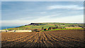
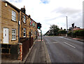
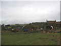
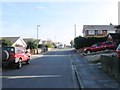
23 photos from this area
Area Information
Key information about the TS12 2PY including its size, population, and administrative classification.
- Area Type
- Postcode
- Area Size
- 2852 m²
- Population
- 1572
- Population Density
- 1203 people/km²
House Prices in TS12 2PY
16
Properties
£61,300
Average Sold Price
£21,000
Lowest Price
£118,000
Highest Price
Showing 16 properties
| Address | Type | Beds | Baths | Last Sale Price | Last Sale Date | |
|---|---|---|---|---|---|---|
| 129 High Street, Brotton, TS12 2PY | Semi-detached | 3 | 1 | £118,000 | Apr 2018 | |
| 135 High Street, Brotton, TS12 2PY | house | 2 | - | £55,000 | Dec 2011 | |
| 128 High Street, Brotton, TS12 2PY | house | 4 | - | £90,000 | Feb 2010 | |
| 130 High Street, Brotton, TS12 2PY | Flat | - | - | £22,500 | Mar 2003 | |
| 127 High Street, Brotton, TS12 2PY | Terraced | - | - | £21,000 | Jul 1998 | |
| 130A High Street, Brotton, TS12 2PY | Flat | 1 | 1 | - | - | |
| Flat 1, 123 High Street, Brotton, TS12 2PY | Flat | 4 | 1 | - | - | |
| 126 High Street, Brotton, TS12 2PY | house | 3 | 1 | - | - | |
| 134 High Street, Brotton, TS12 2PY | Terraced | - | - | - | - | |
| 132 High Street, Brotton, TS12 2PY | Semi-detached | - | - | - | - |
Page 1 of 2
Energy Efficiency in TS12 2PY
Amenities
Schools
| Rank | School | Type | Entry gender | Ages |
|---|
Explore more schools in this area
Go to Schools tabDemographics
Household Size
Two person
most common
Accommodation Type
Houses
most common
Tenure
74
majority
Ethnic Group
White
most common
Religion
N/A
most common
Household Composition
N/A
most common
Age
47
median
Adults (30-64 years)
most common
Household Deprivation
N/A
with no deprivation
NS-SEC
23
in Lower managerial occupations
Explore more demographic insights in this area
Go to Demographics tabPlanning
Planning Constraints
- Flood RiskPremium
- Ramsar Wetland SitesPremium
- Area of Outstanding Natural BeautyPremium
- Protected Nature ReservePremium
- Protected WoodlandPremium