Area Overview for TS12 2FG
Photos of TS12 2FG
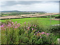
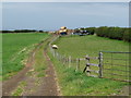
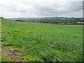
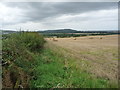
26 photos from this area
Area Information
Key information about the TS12 2FG including its size, population, and administrative classification.
- Area Type
- Postcode
- Area Size
- 4.9 hectares
- Population
- 1222
- Population Density
- 236 people/km²
House Prices in TS12 2FG
31
Properties
£118,765
Average Sold Price
£70,995
Lowest Price
£276,000
Highest Price
Showing 31 properties
| Address | Type | Beds | Baths | Last Sale Price | Last Sale Date | |
|---|---|---|---|---|---|---|
| 27 Collingwood Chase, Brotton, TS12 2FG | Bungalow | 3 | 1 | £276,000 | Jul 2024 | |
| 8 Collingwood Chase, Brotton, TS12 2FG | Detached | 4 | 2 | £245,000 | Apr 2024 | |
| 3 Collingwood Chase, Brotton, TS12 2FG | Bungalow | 3 | 2 | £230,500 | Jul 2021 | |
| 22 Collingwood Chase, Brotton, TS12 2FG | Detached | 4 | 3 | £240,000 | May 2015 | |
| 23 Collingwood Chase, Brotton, TS12 2FG | Bungalow | - | - | £192,000 | Sep 2012 | |
| 4 Collingwood Chase, Brotton, TS12 2FG | Detached | 3 | 1 | £175,500 | Oct 2007 | |
| 14 Collingwood Chase, Brotton, TS12 2FG | Detached | - | - | £212,500 | May 2006 | |
| 5 Collingwood Chase, Brotton, TS12 2FG | Detached | - | - | £145,000 | Jul 2004 | |
| 21 Collingwood Chase, Brotton, TS12 2FG | Detached | - | - | £127,500 | Sep 2003 | |
| 26 Collingwood Chase, Brotton, TS12 2FG | Detached | - | - | £128,000 | Mar 2003 |
Page 1 of 4
Energy Efficiency in TS12 2FG
Amenities
Schools
| Rank | School | Type | Entry gender | Ages |
|---|
Explore more schools in this area
Go to Schools tabDemographics
Household Size
Two person
most common
Accommodation Type
Houses
most common
Tenure
91
majority
Ethnic Group
White
most common
Religion
N/A
most common
Household Composition
N/A
most common
Age
47
median
Adults (30-64 years)
most common
Household Deprivation
N/A
with no deprivation
NS-SEC
27
in Lower managerial occupations
Explore more demographic insights in this area
Go to Demographics tabPlanning
Planning Constraints
- Flood RiskPremium
- Ramsar Wetland SitesPremium
- Area of Outstanding Natural BeautyPremium
- Protected Nature ReservePremium
- Protected WoodlandPremium