Area Overview for TS12 2DE
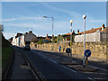
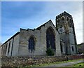
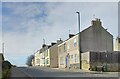
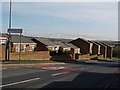
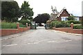
Photos of TS12 2DE
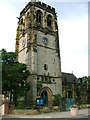
![Robinson Street, Skelton [1] in TS12 2DE](https://images.propbar.co.uk/images/geograph/44/26/4426244_120.jpg)
![Robinson Street, Skelton [2] in TS12 2DE](https://images.propbar.co.uk/images/geograph/44/26/4426267_120.jpg)
20 photos from this area
Area Information
Key information about the TS12 2DE including its size, population, and administrative classification.
- Area Type
- Postcode
- Area Size
- 15.3 hectares
- Population
- 1542
- Population Density
- 172 people/km²
House Prices in TS12 2DE
20
Properties
£70,264
Average Sold Price
£16,000
Lowest Price
£240,000
Highest Price
Showing 20 properties
| Address | Type | Beds | Baths | Last Sale Price | Last Sale Date | |
|---|---|---|---|---|---|---|
| 16 Trout Hall Lane, Skelton Green, TS12 2DE | Terraced | 2 | 1 | £72,500 | Sep 2023 | |
| 8 Trout Hall Lane, Skelton Green, TS12 2DE | Terraced | 3 | 1 | £86,000 | Jun 2023 | |
| 9 TROUT HALL LANE, Skelton Green, TS12 2DE | Detached | 2 | 1 | £80,000 | Feb 2023 | |
| 7 Trout Hall Lane, Skelton Green, TS12 2DE | Cottage | 2 | 1 | £76,500 | Sep 2021 | |
| 10 Trout Hall Lane, Skelton Green, TS12 2DE | Terraced | 3 | 1 | £55,000 | Jan 2019 | |
| 4 Trout Hall Lane, Skelton Green, TS12 2DE | house | - | - | £23,000 | Apr 2018 | |
| 1 Trout Hall Lane, Skelton Green, TS12 2DE | house | 3 | 1 | £66,500 | Jul 2016 | |
| Barn Cottage, Trout Hall Lane, Skelton Green, TS12 2DE | Cottage | 3 | 2 | £240,000 | Jun 2015 | |
| 11 Trout Hall Lane, Skelton Green, TS12 2DE | house | - | - | £75,950 | Jun 2015 | |
| 6 Trout Hall Lane, Skelton Green, TS12 2DE | house | - | - | £72,300 | Jun 2011 |
Page 1 of 2
Energy Efficiency in TS12 2DE
Amenities
Schools
| Rank | School | Type | Entry gender | Ages |
|---|
Explore more schools in this area
Go to Schools tabDemographics
Household Size
Two person
most common
Accommodation Type
Houses
most common
Tenure
68
majority
Ethnic Group
White
most common
Religion
N/A
most common
Household Composition
N/A
most common
Age
47
median
Adults (30-64 years)
most common
Household Deprivation
N/A
with no deprivation
NS-SEC
25
in Lower managerial occupations
Explore more demographic insights in this area
Go to Demographics tabPlanning
Planning Constraints
- Flood RiskPremium
- Ramsar Wetland SitesPremium
- Area of Outstanding Natural BeautyPremium
- Protected Nature ReservePremium
- Protected WoodlandPremium