Area Overview for TS12 1JE
Photos of TS12 1JE
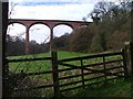
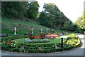
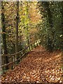
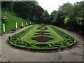
78 photos from this area
Area Information
Key information about the TS12 1JE including its size, population, and administrative classification.
- Area Type
- Postcode
- Area Size
- 1.0 hectares
- Population
- 1504
- Population Density
- 1409 people/km²
House Prices in TS12 1JE
8
Properties
£585,929
Average Sold Price
£283,500
Lowest Price
£920,000
Highest Price
Showing 8 properties
| Address | Type | Beds | Baths | Last Sale Price | Last Sale Date | |
|---|---|---|---|---|---|---|
| The Bungalow, Victoria Terrace, Saltburn By The Sea, TS12 1JE | house | 3 | 2 | £558,000 | Dec 2024 | |
| Hinckley Lodge, Victoria Terrace, Saltburn By The Sea, TS12 1JE | Semi-detached | 3 | 3 | £495,000 | May 2024 | |
| Southrifts, Victoria Terrace, Saltburn By The Sea, TS12 1JE | Detached | 4 | 2 | £920,000 | Apr 2024 | |
| Eastrifts, Victoria Terrace, Saltburn By The Sea, TS12 1JE | Semi-detached | 3 | - | £920,000 | Jan 2022 | |
| Bywood, Victoria Terrace, Saltburn By The Sea, TS12 1JE | house | - | - | £550,000 | Sep 2021 | |
| Alverton, Victoria Terrace, Saltburn By The Sea, TS12 1JE | Semi-detached | - | - | £283,500 | Aug 2006 | |
| Northrifts, Victoria Terrace, Saltburn By The Sea, TS12 1JE | Semi-detached | - | - | £375,000 | Feb 2004 | |
| Dar-es-salaam, Victoria Terrace, Saltburn By The Sea, TS12 1JE | Detached | - | - | - | - |
Energy Efficiency in TS12 1JE
Amenities
Schools
| Rank | School | Type | Entry gender | Ages |
|---|
Explore more schools in this area
Go to Schools tabDemographics
Household Size
Two person
most common
Accommodation Type
Houses
most common
Tenure
87
majority
Ethnic Group
White
most common
Religion
N/A
most common
Household Composition
N/A
most common
Age
47
median
Adults (30-64 years)
most common
Household Deprivation
N/A
with no deprivation
NS-SEC
42
in Lower managerial occupations
Explore more demographic insights in this area
Go to Demographics tabPlanning
Planning Constraints
- Flood RiskPremium
- Ramsar Wetland SitesPremium
- Area of Outstanding Natural BeautyPremium
- Protected Nature ReservePremium
- Protected WoodlandPremium