Area Overview for TS12 1GA
Photos of TS12 1GA
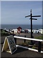
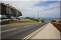

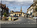
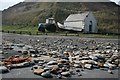


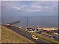


100 photos from this area
Area Information
Key information about the TS12 1GA including its size, population, and administrative classification.
- Area Type
- Postcode
- Area Size
- 1616 m²
- Population
- 1360
- Population Density
- 5117 people/km²
House Prices in TS12 1GA
24
Properties
£131,835
Average Sold Price
£48,500
Lowest Price
£210,000
Highest Price
Showing 24 properties
| Address | Type | Beds | Baths | Last Sale Price | Last Sale Date | |
|---|---|---|---|---|---|---|
| 22, Zetland Court, Dundas Street East, Saltburn By The Sea, TS12 1GA | Flat | 2 | 2 | £210,000 | Mar 2025 | |
| 5, Zetland Court, Dundas Street East, Saltburn By The Sea, TS12 1GA | Flat | 2 | 1 | £169,950 | Jan 2025 | |
| 1, Zetland Court, Dundas Street East, Saltburn By The Sea, TS12 1GA | Flat | - | - | £172,500 | Aug 2024 | |
| 17, Zetland Court, Dundas Street East, Saltburn By The Sea, TS12 1GA | Flat | - | - | £145,000 | Oct 2022 | |
| 12, Zetland Court, Dundas Street East, Saltburn By The Sea, TS12 1GA | Flat | - | - | £162,000 | Mar 2021 | |
| 6, Zetland Court, Dundas Street East, Saltburn By The Sea, TS12 1GA | Flat | - | - | £165,000 | Jul 2020 | |
| 16, Zetland Court, Dundas Street East, Saltburn By The Sea, TS12 1GA | Flat | 2 | 2 | £160,000 | Jul 2018 | |
| 24, Zetland Court, Dundas Street East, Saltburn By The Sea, TS12 1GA | Flat | - | - | £163,500 | Jun 2016 | |
| 4, Zetland Court, Dundas Street East, Saltburn By The Sea, TS12 1GA | Flat | - | - | £151,250 | Feb 2015 | |
| 2, Zetland Court, Dundas Street East, Saltburn By The Sea, TS12 1GA | Flat | - | - | £162,500 | Sep 2014 |
Page 1 of 3
Energy Efficiency in TS12 1GA
Amenities
Schools
| Rank | School | Type | Entry gender | Ages |
|---|
Explore more schools in this area
Go to Schools tabDemographics
Household Size
One person
most common
Accommodation Type
Flats
most common
Tenure
42
majority
Ethnic Group
White
most common
Religion
N/A
most common
Household Composition
N/A
most common
Age
47
median
Adults (30-64 years)
most common
Household Deprivation
N/A
with no deprivation
NS-SEC
32
in Lower managerial occupations
Explore more demographic insights in this area
Go to Demographics tabPlanning
Planning Constraints
- Flood RiskPremium
- Ramsar Wetland SitesPremium
- Area of Outstanding Natural BeautyPremium
- Protected Nature ReservePremium
- Protected WoodlandPremium