Area Overview for TS11 7EN
Photos of TS11 7EN
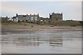

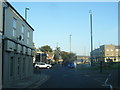
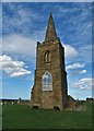
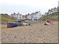

67 photos from this area
Area Information
Key information about the TS11 7EN including its size, population, and administrative classification.
- Area Type
- Postcode
- Area Size
- 8327 m²
- Population
- 1593
- Population Density
- 4032 people/km²
House Prices in TS11 7EN
28
Properties
£137,105
Average Sold Price
£15,000
Lowest Price
£225,000
Highest Price
Showing 28 properties
| Address | Type | Beds | Baths | Last Sale Price | Last Sale Date | |
|---|---|---|---|---|---|---|
| 53 Kirkleatham Avenue, Marske By The Sea, TS11 7EN | Detached | 3 | 2 | £187,000 | Jun 2025 | |
| 41 Kirkleatham Avenue, Marske By The Sea, TS11 7EN | Semi-detached | 3 | 1 | £194,000 | Oct 2024 | |
| 27 Kirkleatham Avenue, Marske By The Sea, TS11 7EN | house | - | - | £148,000 | Jan 2024 | |
| 19 Kirkleatham Avenue, Marske By The Sea, TS11 7EN | house | - | - | £195,000 | Sep 2022 | |
| 31 Kirkleatham Avenue, Marske By The Sea, TS11 7EN | house | - | - | £225,000 | Jun 2022 | |
| 55 Kirkleatham Avenue, Marske By The Sea, TS11 7EN | house | - | - | £180,000 | May 2022 | |
| 33 Kirkleatham Avenue, Marske By The Sea, TS11 7EN | house | - | - | £172,500 | Apr 2021 | |
| 29 Kirkleatham Avenue, Marske By The Sea, TS11 7EN | house | - | - | £144,000 | Apr 2018 | |
| 9 Kirkleatham Avenue, Marske By The Sea, TS11 7EN | house | - | - | £153,000 | Dec 2017 | |
| 51 Kirkleatham Avenue, Marske By The Sea, TS11 7EN | house | - | - | £130,000 | Aug 2015 |
Page 1 of 3
Energy Efficiency in TS11 7EN
Amenities
Schools
| Rank | School | Type | Entry gender | Ages |
|---|
Explore more schools in this area
Go to Schools tabDemographics
Household Size
One person
most common
Accommodation Type
Houses
most common
Tenure
64
majority
Ethnic Group
White
most common
Religion
N/A
most common
Household Composition
N/A
most common
Age
47
median
Adults (30-64 years)
most common
Household Deprivation
N/A
with no deprivation
NS-SEC
32
in Lower managerial occupations
Explore more demographic insights in this area
Go to Demographics tabPlanning
Planning Constraints
- Flood RiskPremium
- Ramsar Wetland SitesPremium
- Area of Outstanding Natural BeautyPremium
- Protected Nature ReservePremium
- Protected WoodlandPremium