Area Overview for TS10 5DB
Photos of TS10 5DB
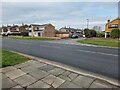
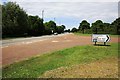
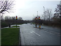
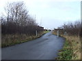

13 photos from this area
Area Information
Key information about the TS10 5DB including its size, population, and administrative classification.
- Area Type
- Postcode
- Area Size
- 1.9 hectares
- Population
- 1132
- Population Density
- 76 people/km²
House Prices in TS10 5DB
54
Properties
£186,273
Average Sold Price
£20,304
Lowest Price
£268,995
Highest Price
Showing 54 properties
| Address | Type | Beds | Baths | Last Sale Price | Last Sale Date | |
|---|---|---|---|---|---|---|
| 78 Cowslip Drive, Redcar, TS10 5DB | Detached | 3 | 2 | £220,000 | Dec 2025 | |
| 12 Cowslip Drive, Redcar, TS10 5DB | house | - | - | £195,000 | Jul 2025 | |
| 32 Cowslip Drive, Redcar, TS10 5DB | house | - | - | £220,000 | Jun 2025 | |
| 24 Cowslip Drive, Redcar, TS10 5DB | Detached | 3 | 2 | £168,152 | Jun 2023 | |
| 22 Cowslip Drive, Redcar, TS10 5DB | Detached | 3 | 2 | £186,212 | Jun 2023 | |
| 30 Cowslip Drive, Redcar, TS10 5DB | Semi-detached | 3 | 1 | £168,152 | Jun 2023 | |
| 26 Cowslip Drive, Redcar, TS10 5DB | Semi-detached | 3 | 1 | £168,152 | Jun 2023 | |
| 28 Cowslip Drive, Redcar, TS10 5DB | house | - | - | £168,152 | Jun 2023 | |
| 62 Cowslip Drive, Redcar, TS10 5DB | house | - | - | £199,995 | May 2022 | |
| 76 Cowslip Drive, Redcar, TS10 5DB | Detached | 4 | 1 | £250,995 | Mar 2022 |
Page 1 of 6
Energy Efficiency in TS10 5DB
Amenities
Schools
| Rank | School | Type | Entry gender | Ages |
|---|
Explore more schools in this area
Go to Schools tabDemographics
Household Size
Two person
most common
Accommodation Type
Houses
most common
Tenure
82
majority
Ethnic Group
White
most common
Religion
N/A
most common
Household Composition
N/A
most common
Age
47
median
Adults (30-64 years)
most common
Household Deprivation
N/A
with no deprivation
NS-SEC
27
in Lower managerial occupations
Explore more demographic insights in this area
Go to Demographics tabPlanning
Planning Constraints
- Flood RiskPremium
- Ramsar Wetland SitesPremium
- Area of Outstanding Natural BeautyPremium
- Protected Nature ReservePremium
- Protected WoodlandPremium