Area Overview for TS10 4NG
Photos of TS10 4NG
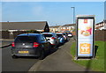
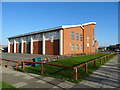
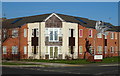
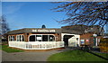
22 photos from this area
Area Information
Key information about the TS10 4NG including its size, population, and administrative classification.
- Area Type
- Postcode
- Area Size
- 1.4 hectares
- Population
- 1199
- Population Density
- 3456 people/km²
House Prices in TS10 4NG
47
Properties
£78,118
Average Sold Price
£31,500
Lowest Price
£145,000
Highest Price
Showing 47 properties
| Address | Type | Beds | Baths | Last Sale Price | Last Sale Date | |
|---|---|---|---|---|---|---|
| 22 Woodside, Redcar, TS10 4NG | Bungalow | 2 | 1 | £87,000 | Aug 2025 | |
| 7 Woodside, Redcar, TS10 4NG | house | - | - | £115,000 | May 2025 | |
| 18 Woodside, Redcar, TS10 4NG | Bungalow | 2 | 1 | £89,500 | Nov 2023 | |
| 2 Woodside, Redcar, TS10 4NG | Bungalow | 2 | 1 | £95,000 | Apr 2023 | |
| 21 Woodside, Redcar, TS10 4NG | house | - | - | £135,000 | Dec 2022 | |
| 17 Woodside, Redcar, TS10 4NG | Detached | 2 | 1 | £145,000 | Jun 2022 | |
| 43 Woodside, Redcar, TS10 4NG | Bungalow | 2 | 1 | £140,000 | Jun 2019 | |
| 23 Woodside, Redcar, TS10 4NG | house | - | - | £112,500 | Jun 2019 | |
| 46 Woodside, Redcar, TS10 4NG | Bungalow | - | - | £83,000 | Jun 2017 | |
| 15 Woodside, Redcar, TS10 4NG | house | - | - | £77,000 | Aug 2014 |
Page 1 of 5
Energy Efficiency in TS10 4NG
Amenities
Schools
| Rank | School | Type | Entry gender | Ages |
|---|
Explore more schools in this area
Go to Schools tabDemographics
Household Size
Two person
most common
Accommodation Type
Houses
most common
Tenure
82
majority
Ethnic Group
White
most common
Religion
N/A
most common
Household Composition
N/A
most common
Age
47
median
Adults (30-64 years)
most common
Household Deprivation
N/A
with no deprivation
NS-SEC
31
in Lower managerial occupations
Explore more demographic insights in this area
Go to Demographics tabPlanning
Planning Constraints
- Flood RiskPremium
- Ramsar Wetland SitesPremium
- Area of Outstanding Natural BeautyPremium
- Protected Nature ReservePremium
- Protected WoodlandPremium