Area Overview for TS10 4AJ
Photos of TS10 4AJ

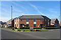
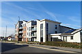
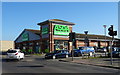
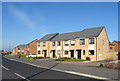
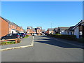
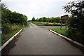

21 photos from this area
Area Information
Key information about the TS10 4AJ including its size, population, and administrative classification.
- Area Type
- Postcode
- Area Size
- 1.8 hectares
- Population
- 1132
- Population Density
- 76 people/km²
House Prices in TS10 4AJ
53
Properties
£123,808
Average Sold Price
£44,500
Lowest Price
£221,000
Highest Price
Showing 53 properties
| Address | Type | Beds | Baths | Last Sale Price | Last Sale Date | |
|---|---|---|---|---|---|---|
| 31 Malvern Avenue, Redcar, TS10 4AJ | Detached | 3 | 1 | £161,500 | Sep 2025 | |
| 35 Malvern Avenue, Redcar, TS10 4AJ | Semi-detached | 3 | 1 | £221,000 | Feb 2025 | |
| 8 Malvern Avenue, Redcar, TS10 4AJ | house | - | - | £185,000 | Aug 2022 | |
| 3 Malvern Avenue, Redcar, TS10 4AJ | house | - | - | £175,000 | Aug 2022 | |
| 48 Malvern Avenue, Redcar, TS10 4AJ | house | - | - | £97,500 | Dec 2019 | |
| 23 Malvern Avenue, Redcar, TS10 4AJ | Semi-detached | 3 | 1 | £102,500 | Oct 2019 | |
| 16 Malvern Avenue, Redcar, TS10 4AJ | house | - | - | £108,000 | Aug 2018 | |
| 57 Malvern Avenue, Redcar, TS10 4AJ | house | - | - | £158,000 | Jul 2018 | |
| 51 Malvern Avenue, Redcar, TS10 4AJ | house | - | - | £145,000 | Nov 2017 | |
| 30 Malvern Avenue, Redcar, TS10 4AJ | house | - | - | £130,000 | Jul 2017 |
Page 1 of 6
Energy Efficiency in TS10 4AJ
Amenities
Schools
| Rank | School | Type | Entry gender | Ages |
|---|
Explore more schools in this area
Go to Schools tabDemographics
Household Size
Two person
most common
Accommodation Type
Houses
most common
Tenure
82
majority
Ethnic Group
White
most common
Religion
N/A
most common
Household Composition
N/A
most common
Age
47
median
Adults (30-64 years)
most common
Household Deprivation
N/A
with no deprivation
NS-SEC
27
in Lower managerial occupations
Explore more demographic insights in this area
Go to Demographics tabPlanning
Planning Constraints
- Flood RiskPremium
- Ramsar Wetland SitesPremium
- Area of Outstanding Natural BeautyPremium
- Protected Nature ReservePremium
- Protected WoodlandPremium