Area Overview for TS10 4AE
Photos of TS10 4AE

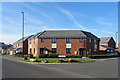
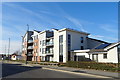
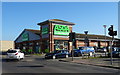
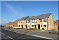
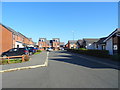

21 photos from this area
Area Information
Key information about the TS10 4AE including its size, population, and administrative classification.
- Area Type
- Postcode
- Area Size
- 1.4 hectares
- Population
- 1132
- Population Density
- 76 people/km²
House Prices in TS10 4AE
35
Properties
£145,691
Average Sold Price
£63,000
Lowest Price
£265,000
Highest Price
Showing 35 properties
| Address | Type | Beds | Baths | Last Sale Price | Last Sale Date | |
|---|---|---|---|---|---|---|
| 1 Pennine Crescent, Redcar, TS10 4AE | Detached | 2 | 1 | £140,000 | Apr 2025 | |
| 17 Pennine Crescent, Redcar, TS10 4AE | house | 4 | 2 | £265,000 | Sep 2024 | |
| 5 Pennine Crescent, Redcar, TS10 4AE | Detached | 2 | 1 | £169,950 | May 2024 | |
| 33 Pennine Crescent, Redcar, TS10 4AE | house | - | - | £141,500 | Aug 2023 | |
| 24 Pennine Crescent, Redcar, TS10 4AE | Detached | 2 | 1 | £175,000 | Oct 2022 | |
| 16 Pennine Crescent, Redcar, TS10 4AE | Retail | 3 | 1 | £210,000 | Jun 2022 | |
| 29 Pennine Crescent, Redcar, TS10 4AE | house | - | - | £215,000 | Mar 2022 | |
| 13 Pennine Crescent, Redcar, TS10 4AE | house | - | - | £160,000 | May 2021 | |
| 43 Pennine Crescent, Redcar, TS10 4AE | Bungalow | 2 | 1 | £160,000 | Oct 2020 | |
| 41 Pennine Crescent, Redcar, TS10 4AE | Bungalow | 2 | 1 | £145,505 | Jul 2017 |
Page 1 of 4
Energy Efficiency in TS10 4AE
Amenities
Schools
| Rank | School | Type | Entry gender | Ages |
|---|
Explore more schools in this area
Go to Schools tabDemographics
Household Size
Two person
most common
Accommodation Type
Houses
most common
Tenure
82
majority
Ethnic Group
White
most common
Religion
N/A
most common
Household Composition
N/A
most common
Age
47
median
Adults (30-64 years)
most common
Household Deprivation
N/A
with no deprivation
NS-SEC
27
in Lower managerial occupations
Explore more demographic insights in this area
Go to Demographics tabPlanning
Planning Constraints
- Flood RiskPremium
- Ramsar Wetland SitesPremium
- Area of Outstanding Natural BeautyPremium
- Protected Nature ReservePremium
- Protected WoodlandPremium