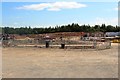
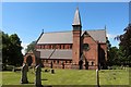
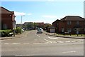
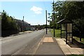
Area Overview for Stillington and Whitton
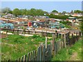
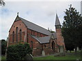
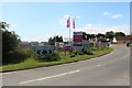
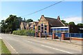
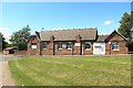
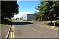
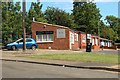
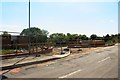
Allotments at Stillington in Stillington and Whitton
St. John's, Stillington in Stillington and Whitton
Building site on the edge of Stillington in Stillington and Whitton
Primary school, Morrison Street, Stillington in Stillington and Whitton
New housing development, Stillington in Stillington and Whitton
Parish Church of St John the Devine, Stillington in Stillington and Whitton
St John's Park, Stillington in Stillington and Whitton
Bus stop, Morrison Street, Stillington in Stillington and Whitton
Stillington Village Hall in Stillington and Whitton
Ironmasters Way, Stillington in Stillington and Whitton
Small businesses, Park Crescent, Stillington in Stillington and Whitton
Building Site, South Street, Stillington in Stillington and Whitton
27 photos from this area

Area Information

What is Stillington and Whitton like to live in? Living in Stillington and Whitton means residing in a compact civil parish covering just 5.6 square kilometres. This small, defined area sits quietly within Tyne and Wear. You will find a community where daily life moves at a measured pace, distinct from the larger urban sprawl nearby. The parish offers a focused environment for those who prefer a tight-knit settlement. Modern amenities exist, but you access them through standard public transport links rather than immediate proximity. This area appeals to people seeking a Defined and Purposeful location. You buy into a specific, contained geography rather than a sprawling district. The neighbourhood identity remains consistent without complex overlays of development or mixed-use zoning. It is a straightforward residential patch within the county structure. Yes, the type is a civil parish. It is also the whole of Tyne and Wear.

Area Type
Parish
Area Size
5.6 km²
Population
Not available
Population Density
Not available

Demographics

Who lives in Stillington and Whitton? The community here is distinctly older than the national average. The median age is 70 years, reflecting a population skewed heavily towards retirees. Most residents fall into the 'Total' age category, suggesting the data aggregates the entire group. You will encounter very few young families or students in this specific demographic frame. Home ownership stands at a high 69%, meaning most people bought their homes outright rather than renting. Sixty-nine percent of households own their property, while the remainder rents or shares. The accommodation types reflect this stability. Diversity metrics are listed as 'Total', indicating a standardised reporting block for the parish. There are no specific diversity sub-groups detailed in the current stats. This creates a homogeneous, settled environment. Deprivation figures are omitted from the current snapshot, but the high ownership rate suggests financial stability among locals.

Household Size

total
most common

Accommodation Type

total
most common

Tenure

69
majority

Ethnic Group

total
most common

Religion

total
most common

Household Composition

total
most common

Age

70
median
Age: Total
most common

Household Deprivation

N/A
with no deprivation

NS-SEC

28
in Lower managerial occupations

Explore more demographic insights in this area

Go to Demographics tab

Planning

Planning Constraints

  • Flood Risk
    Premium
  • Ramsar Wetland Sites
    Premium
  • Area of Outstanding Natural Beauty
    Premium
  • Protected Nature Reserve
    Premium
  • Protected Woodland
    Premium
  • Crime Risk
    Premium

Explore more planning insights in this area

Open Planning map

Frequently Asked Questions

Is this area good for families with young children?
The demographic data shows a median age of 70, meaning the community is skewed towards older adults. Young families are less common here. Housing is predominantly owner-occupied at 69%. This creates a quiet, settled atmosphere rather than a bustling playground environment. You may find it more suited to retirement or established couples.
Will my broadband connection be fast enough for home working?
Fixed broadband scores a 36/100, which describes poor to fair connectivity. While mobile coverage is excellent at 84/100, reliance on a landline line for video conferencing may be an issue. You should contact Openreach to check specific bandwidth speeds for your postcode before moving.
What kind of housing is available in Stillington and Whitton?
The area is characterised by high home ownership, with 69% of households owning their property. The accommodation types are listed as 'Total', suggesting a standardised mix rather than a specific density of flats or terraced housing. The parish covers just 5.6 km², creating a contained residential zone.
Are there any environmental safety concerns like flooding or planning restrictions?
There are no significant environmental risks. Flood risk is low with a score of 5.91/100. There are no Ramsar sites, AONBs, or protected woodlands in the parish. All planning constraint assessments pass, meaning no protected nature reserves are obstructing local development plans.

We use cookies to provide you with the best experience. By continuing, you agree to our Cookie Policy .