Area Overview for Stephenson Ward
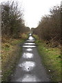
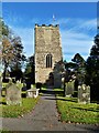
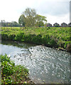
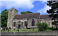
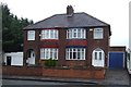
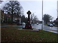
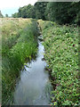
Photos of Stephenson Ward

Area Information
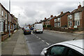
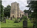
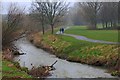
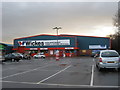
Living in Stephenson Ward offers a specific slice of life within the Borough of Darlington. This electoral ward forms part of the unitary authority in County Durham, situated in North East England. The area is compact, covering just 1.8 square kilometres, which often results in close community ties despite the small footprint. With a population recorded at 4,839 in the 2021 census, Stephenson Ward feels intimate compared to broader urban districts. The community includes equal numbers of males and females, with 2,337 men and 2,504 women calling this space home. Your daily routine will reflect a mature neighbourhood character. The demographic skew suggests an environment established for longer-term residents rather than transient populations. You find yourself in a location that balances suburban quiet with the practical reach of Darlington's central amenities. The ward's geography keeps distances short, meaning local shops, libraries, and schools are likely within easy reach without the need for extensive commuting. This concentration of residents on a limited land area creates a distinct neighbourhood identity. Prospective buyers appreciate knowing exactly who shares the local streets. The boundary is well defined, allowing you to visualise the entire community layout before you move a single box. Stephenson Ward remains a known entity within the local administrative structure, providing a stable backdrop for your living arrangement.
- Area Type
- District Borough Unitary Ward
- Area Size
- 1.8 km²
- Population
- Not available
- Population Density
- Not available
Demographics
The community profile of Stephenson Ward reveals a distinct age-related pattern. The median age stands at 70 years, indicating that the majority of residents belong to the older generations. This high median age defines the social fabric and local services required. You are joining an area where neighbours often share life stages centred on retirement or late in life. The deepest diversity lies within the 'Age: Total' category, though specific breakdowns for youngercohorts remain less prominent compared to seniors. Home ownership presents a significant split in this ward. Only 44% of households own their properties outright. This figure implies that just under half of you are eligible for equity release or mortgage add-ons, while the other half rely on private rentals or shared ownership schemes. You should expect a substantial proportion of the local housing market to operate under rental agreements. Accommodation types and predominant ethnic groupings are present but not highlighted by the most common data points, suggesting a diverse but not necessarily cosmopolitan demographic mix. Religiousofficials remain unrecorded in the primary statistics, which precludes drawing firm conclusions about spiritual centres within the ward. The combination of an elderly population and a low ownership rate characterises this specific market segment. Families with young children may find the pace slower than in areas with younger demographics.
Household Size
Accommodation Type
Tenure
Ethnic Group
Religion
Household Composition
Age
Household Deprivation
NS-SEC
Explore more demographic insights in this area
Go to Demographics tabPlanning
Planning Constraints
- Flood RiskPremium
- Ramsar Wetland SitesPremium
- Area of Outstanding Natural BeautyPremium
- Protected Nature ReservePremium
- Protected WoodlandPremium