Area Overview for Stannington
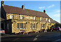
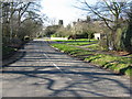
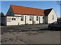
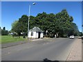
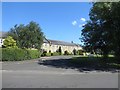
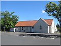
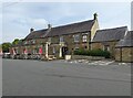
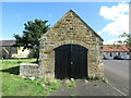
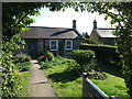
Photos of Stannington


Area Information
Stannington is a compact built-up area in England, covering 23.6 hectares. It is a small, defined community with a population skewed towards older residents, with a median age of 70. This suggests a mature demographic profile, likely shaped by long-term residents and fewer recent arrivals. Living in Stannington means access to essential services within practical reach, including retail outlets, rail networks, and proximity to Newcastle Airport. The area’s size reflects its role as a focused, localised hub rather than a sprawling suburb. While it lacks the density of larger cities, its proximity to rail stations like Cramlington and Morpeth offers connectivity to nearby towns and cities. The presence of Stannington First School, rated good by Ofsted, adds to the area’s appeal for families. Daily life here balances quiet residential living with the convenience of nearby amenities, making it suitable for those prioritising stability and accessibility over urban vibrancy.
- Area Type
- Built Up Area 250
- Area Size
- 23.6 hectares
- Population
- Not available
- Population Density
- Not available
Living in Stannington offers access to a range of nearby amenities, including five retail outlets such as Co-op Netherton, Co-op Morpeth, and Morrisons Red. These shops provide everyday essentials, supporting a self-contained lifestyle. The area’s rail network connects residents to Cramlington and Morpeth stations, enabling travel to larger towns for additional services. Proximity to Newcastle Airport ensures easy access to regional and international travel. While the data does not list parks or leisure facilities, the presence of multiple retail and transport options suggests a practical, convenience-focused lifestyle. The area’s compact size means amenities are within walking or short driving distance, though it may lack the extensive green spaces or cultural venues found in larger towns.
Amenities
Schools
The nearest school to Stannington is Stannington First School, a primary institution with a good Ofsted rating. This school serves the local community, providing education for younger children within the area. The absence of secondary schools in the data suggests that families may need to travel to nearby towns for secondary education, though the proximity to rail stations like Cramlington and Morpeth could facilitate this. The presence of a well-rated primary school is a key factor for families prioritising local education, but the lack of secondary options may influence decisions for households with older children. The school’s good rating indicates a reliable standard of teaching, which is a positive for the area’s appeal to families.
| Rank | School | Type | Entry gender | Ages |
|---|---|---|---|---|
| 1 | Stannington First School | primary | N/A | N/A |
Explore more schools in this area
Go to Schools tabDemographics
The population of Stannington has a median age of 70, indicating a predominantly elderly community. This age profile suggests a demographic where retirement is the primary life stage, with fewer younger households or families. Home ownership is high, at 78%, which aligns with the presence of long-term residents and limited turnover in property. The data does not specify household composition or ethnic diversity, but the figures provided confirm a community where ownership is the norm rather than rental tenancy. The accommodation types are not detailed, but the high home ownership rate implies a mix of semi-detached, terraced, or detached properties typical of older built-up areas. The lack of specific data on deprivation or diversity means the area’s social fabric remains largely opaque, though the low crime risk score of 79 suggests a generally stable environment for residents.
Household Size
Accommodation Type
Tenure
Ethnic Group
Religion
Household Composition
Age
Household Deprivation
NS-SEC
Explore more demographic insights in this area
Go to Demographics tabPlanning
Planning Constraints
- Crime RiskPremium