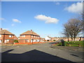
Area Overview for St. Anne's Ward
Photos of St. Anne's Ward


Area Information
St. Anne's Ward is a small electoral ward located within the City of Sunderland metropolitan borough in the North East England region. This district covers an area of exactly 3.2 km², positioning it as a compact neighbourhood within the Houghton and Sunderland South constituency. You are looking at coordinates near 54.89928448929468, -1.4445408455506057, which places you close to Sunderland in Tyne and Wear. Living in St. Anne's Ward means residing in a defined administrative unit that serves local residents with specific civic representation. The area is bounded by broader regional structures, ensuring accessibility to wider council services while maintaining a distinct local identity. Prospective buyers find a relatively small footprint, meaning services and amenities are likely to be within a short travelling distance. This ward functions as a standard part of the local governance map, providing a clear administrative location for utilities, voting, and public services. You are not looking at a remote outpost but an integrated part of the Sunderland landscape. The compact size suggests a walkable environment for some residents, though you must check specific road networks for daily commutes. Understanding the physical dimensions of this 3.2 km² space helps you visualise daily life here.
- Area Type
- District Borough Unitary Ward
- Area Size
- 3.2 km²
- Population
- Not available
- Population Density
- Not available
Demographics
The community profile of St. Anne's Ward is defined by a significantly older population, with a median age of 70 years. You are looking at a neighbourhood where residents are predominantly in their later life stages. Data indicates that Age: Total represents the most common age range category used in local breakdowns, confirming the senior-heavy nature of the demographic. Home ownership stands at 49%, splitting the pressure between owner-occupiers and those renting. This means nearly half of the households in St. Anne's Ward own their property outright or with a mortgage, while almost half are tenants. Household composition and total accommodation types are recorded as aggregate figures, suggesting a diverse range of living arrangements within this small geographic circle. Diversity metrics for predominant ethnic groups and religion are also recorded as totals, reflecting the full spectrum of the local population. With a median age of 70, daily life here may centre around retirement communities, local clubs, and medical services. The lack of young families suggests schools are primarily local catchment points for incoming residents rather than havens for established demographics. Safety assessments reveal a crime risk score of 49, which places the area at medium risk relative to national averages. Standard security precautions remain a sensible approach to daily life here.
Household Size
Accommodation Type
Tenure
Ethnic Group
Religion
Household Composition
Age
Household Deprivation
NS-SEC
Explore more demographic insights in this area
Go to Demographics tabPlanning
Planning Constraints
- Flood RiskPremium
- Ramsar Wetland SitesPremium
- Area of Outstanding Natural BeautyPremium
- Protected Nature ReservePremium
- Protected WoodlandPremium
- Crime RiskPremium