Area Overview for SR8 3TX
Photos of SR8 3TX
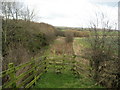
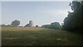
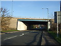
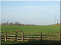
8 photos from this area
Area Information
Key information about the SR8 3TX including its size, population, and administrative classification.
- Area Type
- Postcode
- Area Size
- 38.2 hectares
- Population
- 1635
- Population Density
- 206 people/km²
House Prices in SR8 3TX
8
Properties
£201,099
Average Sold Price
£55,500
Lowest Price
£300,000
Highest Price
Showing 8 properties
| Address | Type | Beds | Baths | Last Sale Price | Last Sale Date | |
|---|---|---|---|---|---|---|
| Birk Crag, Loaning Burn, Easington Village, SR8 3TX | Semi-detached | 3 | 1 | £210,000 | May 2024 | |
| Retanan, Loaning Burn, Easington Village, SR8 3TX | Bungalow | - | - | £300,000 | Jan 2018 | |
| Ambleside, Loaning Burn, Easington Village, SR8 3TX | Semi-detached | - | - | £190,000 | Sep 2009 | |
| Craig Y Don, Loaning Burn, Easington Village, SR8 3TX | house | - | - | £249,995 | Aug 2007 | |
| Breightmet, Loaning Burn, Easington Village, SR8 3TX | Semi-detached | - | - | £55,500 | Mar 1998 | |
| Allan Holme, Loaning Burn, Easington Village, SR8 3TX | Semi-detached | - | - | - | - | |
| Newlands, Loaning Burn, Easington Village, SR8 3TX | Bungalow | - | - | - | - | |
| Aireville, Loaning Burn, Easington Village, SR8 3TX | Semi-detached | - | - | - | - |
Energy Efficiency in SR8 3TX
Amenities
Schools
| Rank | School | Type | Entry gender | Ages |
|---|
Explore more schools in this area
Go to Schools tabDemographics
Household Size
Two person
most common
Accommodation Type
Houses
most common
Tenure
87
majority
Ethnic Group
White
most common
Religion
N/A
most common
Household Composition
N/A
most common
Age
47
median
Adults (30-64 years)
most common
Household Deprivation
N/A
with no deprivation
NS-SEC
40
in Lower managerial occupations
Explore more demographic insights in this area
Go to Demographics tabPlanning
Planning Constraints
- Flood RiskPremium
- Ramsar Wetland SitesPremium
- Area of Outstanding Natural BeautyPremium
- Protected Nature ReservePremium
- Protected WoodlandPremium