Area Overview for SR8 3HU
Photos of SR8 3HU
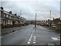
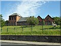
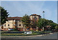
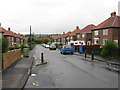
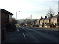
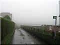
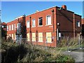
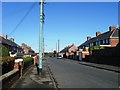
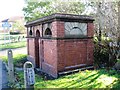
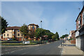

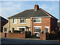
13 photos from this area
Area Information
Key information about the SR8 3HU including its size, population, and administrative classification.
- Area Type
- Postcode
- Area Size
- 2.2 hectares
- Population
- 1879
- Population Density
- 1846 people/km²
House Prices in SR8 3HU
48
Properties
£62,155
Average Sold Price
£12,512
Lowest Price
£120,000
Highest Price
Showing 48 properties
| Address | Type | Beds | Baths | Last Sale Price | Last Sale Date | |
|---|---|---|---|---|---|---|
| 99 Oak Road, Easington Colliery, SR8 3HU | Semi-detached | 2 | 1 | £65,500 | Jul 2024 | |
| 88 Oak Road, Easington Colliery, SR8 3HU | Semi-detached | 3 | 1 | £85,000 | Apr 2024 | |
| 73 Oak Road, Easington Colliery, SR8 3HU | Semi-detached | 3 | 1 | £120,000 | Feb 2024 | |
| 101 Oak Road, Easington Colliery, SR8 3HU | Semi-detached | 3 | 1 | £88,000 | Jun 2022 | |
| 117 Oak Road, Easington Colliery, SR8 3HU | house | - | - | £90,000 | Apr 2022 | |
| 108 Oak Road, Easington Colliery, SR8 3HU | Semi-detached | 2 | 1 | £60,500 | Mar 2022 | |
| 105 Oak Road, Easington Colliery, SR8 3HU | house | 2 | - | £53,500 | Sep 2021 | |
| 104 Oak Road, Easington Colliery, SR8 3HU | Semi-detached | 3 | - | £99,950 | Jun 2021 | |
| 114 Oak Road, Easington Colliery, SR8 3HU | Semi-detached | 2 | 1 | £56,500 | Jul 2020 | |
| 109 Oak Road, Easington Colliery, SR8 3HU | Semi-detached | 2 | 1 | £58,500 | Jul 2020 |
Page 1 of 5
Energy Efficiency in SR8 3HU
Amenities
Schools
| Rank | School | Type | Entry gender | Ages |
|---|
Explore more schools in this area
Go to Schools tabDemographics
Household Size
One person
most common
Accommodation Type
Houses
most common
Tenure
54
majority
Ethnic Group
White
most common
Religion
N/A
most common
Household Composition
N/A
most common
Age
47
median
Adults (30-64 years)
most common
Household Deprivation
N/A
with no deprivation
NS-SEC
18
in Lower managerial occupations
Explore more demographic insights in this area
Go to Demographics tabPlanning
Planning Constraints
- Flood RiskPremium
- Ramsar Wetland SitesPremium
- Area of Outstanding Natural BeautyPremium
- Protected Nature ReservePremium
- Protected WoodlandPremium