Area Overview for SR8 2EJ
Photos of SR8 2EJ
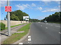
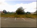
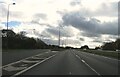
7 photos from this area
Area Information
Key information about the SR8 2EJ including its size, population, and administrative classification.
- Area Type
- Postcode
- Area Size
- 3.1 hectares
- Population
- 1205
- Population Density
- 2756 people/km²
House Prices in SR8 2EJ
48
Properties
£67,928
Average Sold Price
£19,000
Lowest Price
£99,000
Highest Price
Showing 48 properties
| Address | Type | Beds | Baths | Last Sale Price | Last Sale Date | |
|---|---|---|---|---|---|---|
| 43 Chester Place, Peterlee, SR8 2EJ | Terraced | 3 | 1 | £90,000 | Jun 2025 | |
| 41 Chester Place, Peterlee, SR8 2EJ | Terraced | 3 | 1 | £77,000 | Jul 2023 | |
| 34 Chester Place, Peterlee, SR8 2EJ | Terraced | 3 | 1 | £85,000 | May 2023 | |
| 16 Chester Place, Peterlee, SR8 2EJ | Terraced | 3 | - | £79,000 | Jun 2021 | |
| 40 Chester Place, Peterlee, SR8 2EJ | Terraced | 3 | - | £75,000 | Jun 2021 | |
| 6 Chester Place, Peterlee, SR8 2EJ | Terraced | 3 | 1 | £75,000 | Dec 2020 | |
| 10 Chester Place, Peterlee, SR8 2EJ | Terraced | 3 | 1 | £75,000 | Aug 2016 | |
| 39 Chester Place, Peterlee, SR8 2EJ | house | - | - | £90,000 | May 2015 | |
| 32 Chester Place, Peterlee, SR8 2EJ | Terraced | 3 | 1 | £95,000 | Oct 2008 | |
| 33 Chester Place, Peterlee, SR8 2EJ | house | - | - | £99,000 | Jun 2008 |
Page 1 of 5
Energy Efficiency in SR8 2EJ
Amenities
Schools
| Rank | School | Type | Entry gender | Ages |
|---|
Explore more schools in this area
Go to Schools tabDemographics
Household Size
Two person
most common
Accommodation Type
Houses
most common
Tenure
50
majority
Ethnic Group
White
most common
Religion
N/A
most common
Household Composition
N/A
most common
Age
47
median
Adults (30-64 years)
most common
Household Deprivation
N/A
with no deprivation
NS-SEC
16
in Lower managerial occupations
Explore more demographic insights in this area
Go to Demographics tabPlanning
Planning Constraints
- Flood RiskPremium
- Ramsar Wetland SitesPremium
- Area of Outstanding Natural BeautyPremium
- Protected Nature ReservePremium
- Protected WoodlandPremium