Area Overview for SR8 2BY
Photos of SR8 2BY
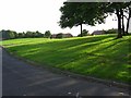
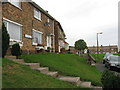
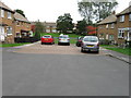
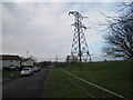
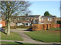
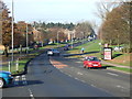
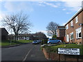
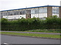
8 photos from this area
Area Information
Key information about the SR8 2BY including its size, population, and administrative classification.
- Area Type
- Postcode
- Area Size
- 1.3 hectares
- Population
- 1461
- Population Density
- 5886 people/km²
House Prices in SR8 2BY
20
Properties
£79,693
Average Sold Price
£31,500
Lowest Price
£110,000
Highest Price
Showing 20 properties
| Address | Type | Beds | Baths | Last Sale Price | Last Sale Date | |
|---|---|---|---|---|---|---|
| 3 Northampton Road, Peterlee, SR8 2BY | Terraced | 2 | 1 | £95,000 | Aug 2022 | |
| 11 Northampton Road, Peterlee, SR8 2BY | Terraced | 4 | - | £99,995 | Feb 2020 | |
| 14 Northampton Road, Peterlee, SR8 2BY | house | - | - | £81,000 | Jun 2015 | |
| 4 Northampton Road, Peterlee, SR8 2BY | house | - | - | £79,000 | Apr 2012 | |
| 9 Northampton Road, Peterlee, SR8 2BY | Terraced | 2 | 1 | £60,000 | Jun 2011 | |
| 18 Northampton Road, Peterlee, SR8 2BY | Terraced | 3 | 1 | £110,000 | Feb 2008 | |
| 19 Northampton Road, Peterlee, SR8 2BY | Terraced | - | - | £97,000 | Apr 2007 | |
| 1 Northampton Road, Peterlee, SR8 2BY | house | - | - | £94,950 | Oct 2005 | |
| 16 Northampton Road, Peterlee, SR8 2BY | Semi-detached | - | - | £91,000 | Sep 2005 | |
| 6 Northampton Road, Peterlee, SR8 2BY | Terraced | - | - | £73,500 | Aug 2003 |
Page 1 of 2
Energy Efficiency in SR8 2BY
Amenities
Schools
| Rank | School | Type | Entry gender | Ages |
|---|
Explore more schools in this area
Go to Schools tabDemographics
Household Size
One person
most common
Accommodation Type
Houses
most common
Tenure
70
majority
Ethnic Group
White
most common
Religion
N/A
most common
Household Composition
N/A
most common
Age
47
median
Adults (30-64 years)
most common
Household Deprivation
N/A
with no deprivation
NS-SEC
23
in Lower managerial occupations
Explore more demographic insights in this area
Go to Demographics tabPlanning
Planning Constraints
- Flood RiskPremium
- Ramsar Wetland SitesPremium
- Area of Outstanding Natural BeautyPremium
- Protected Nature ReservePremium
- Protected WoodlandPremium