Area Overview for SR7 8DB
Photos of SR7 8DB
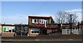
9 photos from this area
Area Information
Key information about the SR7 8DB including its size, population, and administrative classification.
- Area Type
- Postcode
- Area Size
- 6468 m²
- Population
- 1215
- Population Density
- 5791 people/km²
House Prices in SR7 8DB
25
Properties
£97,274
Average Sold Price
£49,000
Lowest Price
£125,000
Highest Price
Showing 25 properties
| Address | Type | Beds | Baths | Last Sale Price | Last Sale Date | |
|---|---|---|---|---|---|---|
| 18 Holyhead Close, Seaham, SR7 8DB | house | - | - | £49,000 | May 2024 | |
| 26 Holyhead Close, Seaham, SR7 8DB | house | - | - | £62,600 | May 2024 | |
| 7 Holyhead Close, Seaham, SR7 8DB | Terraced | 2 | 1 | £60,000 | Nov 2021 | |
| 3 Holyhead Close, Seaham, SR7 8DB | house | - | - | £67,000 | May 2021 | |
| 15 Holyhead Close, Seaham, SR7 8DB | Terraced | 2 | 1 | £65,000 | Mar 2019 | |
| 12 Holyhead Close, Seaham, SR7 8DB | house | - | - | £69,000 | Sep 2013 | |
| 23 Holyhead Close, Seaham, SR7 8DB | Terraced | - | - | £85,000 | Jul 2008 | |
| 6 Holyhead Close, Seaham, SR7 8DB | Terraced | 2 | 1 | £109,408 | Jul 2007 | |
| 24 Holyhead Close, Seaham, SR7 8DB | house | 2 | 1 | £109,408 | Jun 2007 | |
| 1 Holyhead Close, Seaham, SR7 8DB | house | 2 | 1 | £109,650 | Jun 2007 |
Page 1 of 3
Energy Efficiency in SR7 8DB
Amenities
Schools
| Rank | School | Type | Entry gender | Ages |
|---|
Explore more schools in this area
Go to Schools tabDemographics
Household Size
Family (3-5 people)
most common
Accommodation Type
Houses
most common
Tenure
48
majority
Ethnic Group
White
most common
Religion
N/A
most common
Household Composition
N/A
most common
Age
47
median
Adults (30-64 years)
most common
Household Deprivation
N/A
with no deprivation
NS-SEC
16
in Lower managerial occupations
Explore more demographic insights in this area
Go to Demographics tabPlanning
Planning Constraints
- Flood RiskPremium
- Ramsar Wetland SitesPremium
- Area of Outstanding Natural BeautyPremium
- Protected Nature ReservePremium
- Protected WoodlandPremium