Area Overview for SR7 7SB
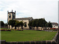
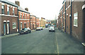
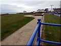
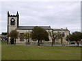
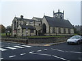
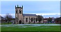
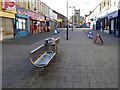
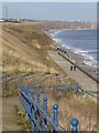
Photos of SR7 7SB

Area Information
SR7 7SB represents a very small residential cluster on the edge of England, covering an area of only 9,263 square metres. This limited footprint results in a high population density of 160,527 people per square kilometre, which gives the neighbourhood an intense, compact feel. Despite its size, the area supports a distinct community of 1,487 residents who manage their daily lives within close proximity to one another. Living in SR7 7SB means you are part of a tightly knit environment where local interactions are frequent due to the sheer concentration of households in such a small space. The postcode area is defined by its residential focus rather than commercial expansion, making it a quiet yet crowded slice of the wider region. You will find that life here revolves around shared local resources rather than the privacy of a sprawling estate. The specific geography of this cluster creates a unique atmosphere shaped by its high density and clear boundaries. Potential buyers should recognise that this location offers a specific type of urban cohesion that differs from more spread-out suburbs.
- Area Type
- Postcode
- Area Size
- 9263 m²
- Population
- 1487
- Population Density
- 160527 people/km²
The property market in SR7 7SB is characterised by a large concentration of houses, which defines the primary housing stock for buyers. With 44% home ownership rates, this area presents a mixed landscape where purchasing a home is common but not universal for every resident. You will find that the housing options focus on house styles rather than fibre flats or high-density apartments. This type offers buyers a traditional residential feel, often providing more privacy and garden space per household compared to urban flats. For those looking at this specific postcode, the dominance of houses means you are dealing with a market that values ground-level access and indoor-outdoor living spaces. The relatively low home ownership percentage also indicates a significant rental sector, suggesting a steady stream of tenants moving in and out of these properties. Whether you are an individual investor or a family seeking a family home in SR7 7SB, the inventory revolves around the house format. This structure keeps the visual character of the area consistent across the 9,263 square metres of land available for development.
House Prices in SR7 7SB
Showing 28 properties
| Address | Type | Beds | Baths | Last Sale Price | Last Sale Date | |
|---|---|---|---|---|---|---|
| 36 Marlborough, Seaham, SR7 7SB | house | 2 | 1 | £75,200 | Dec 2024 | |
| 45 Marlborough, Seaham, SR7 7SB | house | - | - | £92,500 | Jul 2023 | |
| 40 Marlborough, Seaham, SR7 7SB | Terraced | - | - | £70,000 | Apr 2022 | |
| 35 Marlborough, Seaham, SR7 7SB | Semi-detached | 2 | 1 | £80,000 | Mar 2021 | |
| 32 Marlborough, Seaham, SR7 7SB | Flat | - | - | £71,000 | Feb 2021 | |
| 48 Marlborough, Seaham, SR7 7SB | house | - | - | £57,000 | Jun 2020 | |
| 34 Marlborough, Seaham, SR7 7SB | house | 2 | - | £83,000 | Apr 2018 | |
| 47 Marlborough, Seaham, SR7 7SB | Terraced | 2 | - | £68,000 | Sep 2013 | |
| 33 Marlborough, Seaham, SR7 7SB | Flat | - | - | £61,000 | Jun 2009 | |
| 46 Marlborough, Seaham, SR7 7SB | Terraced | - | - | £95,000 | Sep 2008 |
Energy Efficiency in SR7 7SB
Residents of SR7 7SB enjoy convenient access to a variety of retail and leisure facilities located just a short drive away. You can easily reach Aldi Dawdon, Farmfoods Dawdon, and Asda Seaham for weekly grocery shopping, ensuring daily essentials are available without travel. Transport links are equally accessible, with four rail stations including Seaham Railway Station, Sunderland Railway Station, and Horden Peterlee Station lying within practical commuting distance. For entertainment and social activities, visitors can reach key metropolitan landmarks such as Park Lane, the University, and the Stadium Of Light. These venues provide diverse options for cinema, dining, sports, and leisure without requiring a long journey from your doorstep. Living in SR7 7SB means balancing a quiet residential day with vibrant evening opportunities nearby. The mix of supermarkets, train lines, and major venues like the Stadium Of Light creates a lifestyle that feels both private and connected to the wider region. Your weekend plans might involve a match at the stadium or a casual lunch near the university campus.
Amenities
Schools
| Rank | School | Type | Entry gender | Ages |
|---|
Explore more schools in this area
Go to Schools tabDemographics
The community in SR7 7SB reflects an established population with a median age of 47 years. Most residents fall within the broad age range of adults between 30 and 64 years, indicating a neighbourhood dominated by those in their working years and later stages of professional life. House ownership stands at 44%, suggesting that nearly half of the housing stock is rented or held otherwise, while a significant portion of residents remain owner-occupiers. Houses form the primary accommodation type, meaning you will predominantly encounter standalone or semi-detached buildings rather than flats or terraced rows. The population is also predominantly White, contributing to a relatively homogenous social structure. This demographic profile suggests a stable community where families and individuals in mid-life often settle. With a high density of people living in houses, the area likely sees consistent turnover of residents who have put down local roots. When considering homes in SR7 7SB, you are entering a market populated by long-term residents and adults navigating the peak of their adult lives.
Household Size
Accommodation Type
Tenure
Ethnic Group
Religion
Household Composition
Age
Household Deprivation
NS-SEC
Explore more demographic insights in this area
Go to Demographics tabPlanning
Planning Constraints
- Flood RiskPremium
- Ramsar Wetland SitesPremium
- Area of Outstanding Natural BeautyPremium
- Protected Nature ReservePremium
- Protected WoodlandPremium