Area Overview for SR7 0PB
Photos of SR7 0PB
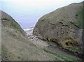
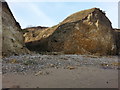
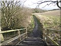
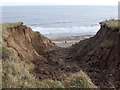
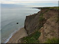
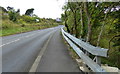

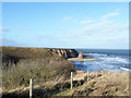
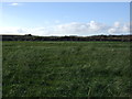
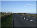
18 photos from this area
Area Information
Key information about the SR7 0PB including its size, population, and administrative classification.
- Area Type
- Postcode
- Area Size
- 62.8 hectares
- Population
- 2007
- Population Density
- 741 people/km²
House Prices in SR7 0PB
25
Properties
£300,517
Average Sold Price
£56,000
Lowest Price
£870,000
Highest Price
Showing 25 properties
| Address | Type | Beds | Baths | Last Sale Price | Last Sale Date | |
|---|---|---|---|---|---|---|
| East Cherry Knowle Farm, Stockton Road, Seaham, SR7 0PB | Semi-detached | 3 | 1 | £340,000 | May 2025 | |
| Glenholme, Stockton Road, Seaham, SR7 0PB | Semi-detached | 4 | 1 | £207,500 | Jan 2025 | |
| Sunnydale, Stockton Road, Seaham, SR7 0PB | Bungalow | 1 | 1 | £250,000 | Dec 2023 | |
| West Wynd, Stockton Road, Seaham, SR7 0PB | house | - | - | £700,000 | Dec 2021 | |
| The Bungalow, Stockton Road, Seaham, SR7 0PB | Bungalow | 3 | 3 | £325,000 | Dec 2020 | |
| Kenmore, Stockton Road, Seaham, SR7 0PB | Detached | 4 | 1 | £315,000 | Nov 2020 | |
| Belvedere, Stockton Road, Seaham, SR7 0PB | Semi-detached | 3 | 1 | £180,000 | Oct 2020 | |
| Sunnybrae, Stockton Road, Seaham, SR7 0PB | house | 4 | - | £345,000 | Sep 2019 | |
| East Cherry Knowle Barn, Stockton Road, Seaham, SR7 0PB | Semi-detached | 5 | 4 | £870,000 | Nov 2017 | |
| Almora, Stockton Road, Seaham, SR7 0PB | Bungalow | 3 | - | £285,000 | Jul 2014 |
Page 1 of 3
Energy Efficiency in SR7 0PB
Amenities
Schools
| Rank | School | Type | Entry gender | Ages |
|---|
Explore more schools in this area
Go to Schools tabDemographics
Household Size
Family (3-5 people)
most common
Accommodation Type
Houses
most common
Tenure
85
majority
Ethnic Group
White
most common
Religion
N/A
most common
Household Composition
N/A
most common
Age
47
median
Adults (30-64 years)
most common
Household Deprivation
N/A
with no deprivation
NS-SEC
45
in Lower managerial occupations
Explore more demographic insights in this area
Go to Demographics tabPlanning
Planning Constraints
- Flood RiskPremium
- Ramsar Wetland SitesPremium
- Area of Outstanding Natural BeautyPremium
- Protected Nature ReservePremium
- Protected WoodlandPremium