Area Overview for SR7 0JH
Photos of SR7 0JH


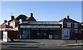
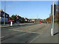
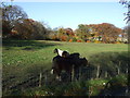
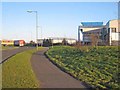
15 photos from this area
Area Information
Key information about the SR7 0JH including its size, population, and administrative classification.
- Area Type
- Postcode
- Area Size
- 5713 m²
- Population
- 1523
- Population Density
- 243 people/km²
House Prices in SR7 0JH
18
Properties
£136,083
Average Sold Price
£48,500
Lowest Price
£175,000
Highest Price
Showing 18 properties
| Address | Type | Beds | Baths | Last Sale Price | Last Sale Date | |
|---|---|---|---|---|---|---|
| 67 Burdon Crescent, Seaham, SR7 0JH | house | - | - | £175,000 | Mar 2025 | |
| 93 Burdon Crescent, Seaham, SR7 0JH | Semi-detached | 2 | 1 | £136,500 | Jan 2020 | |
| 75 Burdon Crescent, Seaham, SR7 0JH | Semi-detached | 3 | - | £147,500 | Dec 2019 | |
| 73 Burdon Crescent, Seaham, SR7 0JH | Semi-detached | 3 | 1 | £138,000 | Jul 2016 | |
| 65 Burdon Crescent, Seaham, SR7 0JH | house | - | - | £171,000 | Jan 2014 | |
| 79 Burdon Crescent, Seaham, SR7 0JH | Semi-detached | - | - | £48,500 | Sep 1998 | |
| 71 Burdon Crescent, Seaham, SR7 0JH | Semi-detached | 3 | 1 | - | - | |
| 95 Burdon Crescent, Seaham, SR7 0JH | Detached | 3 | 1 | - | - | |
| 91 Burdon Crescent, Seaham, SR7 0JH | Terraced | - | - | - | - | |
| 89 Burdon Crescent, Seaham, SR7 0JH | Terraced | - | - | - | - |
Page 1 of 2
Energy Efficiency in SR7 0JH
Amenities
Schools
| Rank | School | Type | Entry gender | Ages |
|---|
Explore more schools in this area
Go to Schools tabDemographics
Household Size
Two person
most common
Accommodation Type
Houses
most common
Tenure
90
majority
Ethnic Group
White
most common
Religion
N/A
most common
Household Composition
N/A
most common
Age
47
median
Adults (30-64 years)
most common
Household Deprivation
N/A
with no deprivation
NS-SEC
35
in Lower managerial occupations
Explore more demographic insights in this area
Go to Demographics tabPlanning
Planning Constraints
- Flood RiskPremium
- Ramsar Wetland SitesPremium
- Area of Outstanding Natural BeautyPremium
- Protected Nature ReservePremium
- Protected WoodlandPremium