Area Overview for SR6 9EG
Photos of SR6 9EG
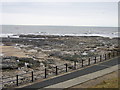

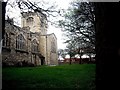
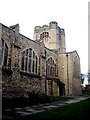
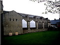

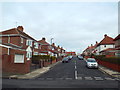
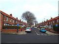
100 photos from this area
Area Information
Key information about the SR6 9EG including its size, population, and administrative classification.
- Area Type
- Postcode
- Area Size
- 4739 m²
- Population
- 1459
- Population Density
- 307868 people/km²
House Prices in SR6 9EG
36
Properties
£121,279
Average Sold Price
£42,000
Lowest Price
£179,950
Highest Price
Showing 36 properties
| Address | Type | Beds | Baths | Last Sale Price | Last Sale Date | |
|---|---|---|---|---|---|---|
| 7 Rosedale Terrace, Fulwell, Sunderland, SR6 9EG | Terraced | 2 | 1 | £148,500 | Mar 2025 | |
| 6 Rosedale Terrace, Fulwell, Sunderland, SR6 9EG | Terraced | 2 | 1 | £177,000 | Nov 2024 | |
| 2 Rosedale Terrace, Fulwell, Sunderland, SR6 9EG | Terraced | 2 | - | £137,500 | Sep 2023 | |
| 9 Rosedale Terrace, Fulwell, Sunderland, SR6 9EG | house | - | - | £179,950 | Jul 2023 | |
| 11 Rosedale Terrace, Fulwell, Sunderland, SR6 9EG | Terraced | 2 | 1 | £140,000 | Jul 2023 | |
| 26 Rosedale Terrace, Fulwell, Sunderland, SR6 9EG | Terraced | 2 | 1 | £105,000 | Jun 2022 | |
| 23 Rosedale Terrace, Fulwell, Sunderland, SR6 9EG | Terraced | 3 | - | £165,000 | Mar 2022 | |
| 36 Rosedale Terrace, Fulwell, Sunderland, SR6 9EG | house | - | - | £175,000 | Nov 2021 | |
| 12 Rosedale Terrace, Fulwell, Sunderland, SR6 9EG | Terraced | 3 | 1 | £162,950 | Oct 2021 | |
| 17 Rosedale Terrace, Fulwell, Sunderland, SR6 9EG | Terraced | 3 | 1 | £149,950 | Mar 2021 |
Page 1 of 4
Energy Efficiency in SR6 9EG
Amenities
Schools
| Rank | School | Type | Entry gender | Ages |
|---|
Explore more schools in this area
Go to Schools tabDemographics
Household Size
One person
most common
Accommodation Type
Houses
most common
Tenure
79
majority
Ethnic Group
White
most common
Religion
N/A
most common
Household Composition
N/A
most common
Age
47
median
Adults (30-64 years)
most common
Household Deprivation
N/A
with no deprivation
NS-SEC
32
in Lower managerial occupations
Explore more demographic insights in this area
Go to Demographics tabPlanning
Planning Constraints
- Flood RiskPremium
- Ramsar Wetland SitesPremium
- Area of Outstanding Natural BeautyPremium
- Protected Nature ReservePremium
- Protected WoodlandPremium