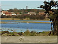
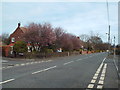
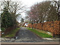
Area Overview for SR6 7RA
Photos of SR6 7RA
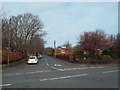

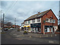
![Junction of Woodlands Road and Whitburn Road [B1299] in SR6 7RA](https://images.propbar.co.uk/images/geograph/53/02/5302753_120.jpg)
45 photos from this area
Area Information
Key information about the SR6 7RA including its size, population, and administrative classification.
- Area Type
- Postcode
- Area Size
- 1.9 hectares
- Population
- 1440
- Population Density
- 4108 people/km²
House Prices in SR6 7RA
15
Properties
£522,772
Average Sold Price
£380,000
Lowest Price
£679,950
Highest Price
Showing 15 properties
| Address | Type | Beds | Baths | Last Sale Price | Last Sale Date | |
|---|---|---|---|---|---|---|
| Cairn Doon, 3 Marsden Road, Cleadon, SR6 7RA | house | - | - | £630,000 | Mar 2025 | |
| Braithwaite, 24 Marsden Road, Cleadon, SR6 7RA | house | - | - | £679,950 | Jun 2021 | |
| The Lawns, 19 Marsden Road, Cleadon, SR6 7RA | house | - | - | £615,000 | Mar 2021 | |
| Mellowstones, 9 Marsden Road, Cleadon, SR6 7RA | Bungalow | 4 | 3 | £647,500 | Jul 2019 | |
| 27 Marsden Road, Cleadon, SR6 7RA | Bungalow | - | - | £480,000 | Aug 2016 | |
| Enfield, 1 Marsden Road, Cleadon, SR6 7RA | Detached | 4 | 3 | £380,000 | Apr 2014 | |
| The Hawthorns, 5 Marsden Road, Cleadon, SR6 7RA | Bungalow | 3 | - | £412,500 | Mar 2011 | |
| Winifred House, 22 Marsden Road, Cleadon, SR6 7RA | house | - | - | £420,000 | Dec 2009 | |
| Lomond, 15 Marsden Road, Cleadon, SR6 7RA | Detached | - | - | £440,000 | Jun 2006 | |
| South House, 18 Marsden Road, Cleadon, SR6 7RA | house | 5 | 3 | - | - |
Page 1 of 2
Energy Efficiency in SR6 7RA
Amenities
Schools
| Rank | School | Type | Entry gender | Ages |
|---|
Explore more schools in this area
Go to Schools tabDemographics
Household Size
Two person
most common
Accommodation Type
Houses
most common
Tenure
96
majority
Ethnic Group
White
most common
Religion
N/A
most common
Household Composition
N/A
most common
Age
47
median
Adults (30-64 years)
most common
Household Deprivation
N/A
with no deprivation
NS-SEC
48
in Lower managerial occupations
Explore more demographic insights in this area
Go to Demographics tabPlanning
Planning Constraints
- Flood RiskPremium
- Ramsar Wetland SitesPremium
- Area of Outstanding Natural BeautyPremium
- Protected Nature ReservePremium
- Protected WoodlandPremium