Area Overview for SR6 0NG
Photos of SR6 0NG
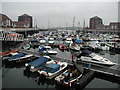

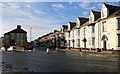
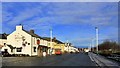
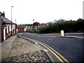
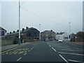
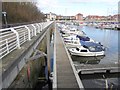
100 photos from this area
Area Information
Key information about the SR6 0NG including its size, population, and administrative classification.
- Area Type
- Postcode
- Area Size
- 4483 m²
- Population
- 1302
- Population Density
- 3653 people/km²
House Prices in SR6 0NG
32
Properties
£95,492
Average Sold Price
£13,200
Lowest Price
£165,000
Highest Price
Showing 32 properties
| Address | Type | Beds | Baths | Last Sale Price | Last Sale Date | |
|---|---|---|---|---|---|---|
| 10 Cooper Street, Sunderland, SR6 0NG | Terraced | 4 | 1 | £165,000 | Feb 2023 | |
| 27 Cooper Street, Sunderland, SR6 0NG | house | - | - | £140,000 | Jun 2021 | |
| 15 Cooper Street, Sunderland, SR6 0NG | Terraced | 2 | 1 | £120,000 | Aug 2020 | |
| 31 Cooper Street, Sunderland, SR6 0NG | Terraced | 2 | 2 | £89,950 | Dec 2018 | |
| 28 Cooper Street, Sunderland, SR6 0NG | house | - | - | £76,250 | Sep 2014 | |
| 25 Cooper Street, Sunderland, SR6 0NG | Terraced | 2 | - | £104,950 | Jun 2014 | |
| 30 Cooper Street, Sunderland, SR6 0NG | Terraced | - | - | £30,000 | Aug 2013 | |
| 18 Cooper Street, Sunderland, SR6 0NG | house | - | - | £90,000 | Jun 2013 | |
| 17 Cooper Street, Sunderland, SR6 0NG | house | 3 | - | £112,050 | Oct 2012 | |
| 9 Cooper Street, Sunderland, SR6 0NG | house | 3 | - | £90,000 | May 2011 |
Page 1 of 4
Energy Efficiency in SR6 0NG
Amenities
Schools
| Rank | School | Type | Entry gender | Ages |
|---|
Explore more schools in this area
Go to Schools tabDemographics
Household Size
Two person
most common
Accommodation Type
Houses
most common
Tenure
74
majority
Ethnic Group
White
most common
Religion
N/A
most common
Household Composition
N/A
most common
Age
47
median
Adults (30-64 years)
most common
Household Deprivation
N/A
with no deprivation
NS-SEC
40
in Lower managerial occupations
Explore more demographic insights in this area
Go to Demographics tabPlanning
Planning Constraints
- Flood RiskPremium
- Ramsar Wetland SitesPremium
- Area of Outstanding Natural BeautyPremium
- Protected Nature ReservePremium
- Protected WoodlandPremium