Area Overview for SR6 0LJ
Photos of SR6 0LJ
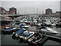
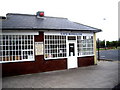
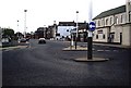
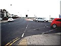

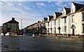
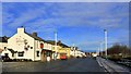
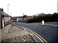
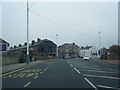
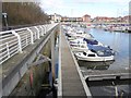
100 photos from this area
Area Information
Key information about the SR6 0LJ including its size, population, and administrative classification.
- Area Type
- Postcode
- Area Size
- 1.3 hectares
- Population
- 1402
- Population Density
- 111929 people/km²
House Prices in SR6 0LJ
49
Properties
£109,217
Average Sold Price
£34,000
Lowest Price
£198,750
Highest Price
Showing 49 properties
| Address | Type | Beds | Baths | Last Sale Price | Last Sale Date | |
|---|---|---|---|---|---|---|
| 67 Hartington Street, Sunderland, SR6 0LJ | Terraced | 2 | 1 | £125,000 | Apr 2025 | |
| 70 Hartington Street, Sunderland, SR6 0LJ | Terraced | 3 | 2 | £110,000 | Dec 2024 | |
| 106 Hartington Street, Sunderland, SR6 0LJ | Terraced | 3 | 1 | £165,000 | Oct 2024 | |
| 90 Hartington Street, Sunderland, SR6 0LJ | Terraced | 3 | 2 | £165,000 | Aug 2024 | |
| 56 Hartington Street, Sunderland, SR6 0LJ | Bungalow | - | - | £84,000 | Jun 2024 | |
| 69 Hartington Street, Sunderland, SR6 0LJ | Bungalow | - | - | £85,000 | Mar 2024 | |
| 80 Hartington Street, Sunderland, SR6 0LJ | Terraced | 2 | 1 | £161,428 | Dec 2023 | |
| 62 Hartington Street, Sunderland, SR6 0LJ | Bungalow | - | - | £130,000 | Sep 2022 | |
| 74 Hartington Street, Sunderland, SR6 0LJ | Terraced | 2 | 2 | £135,000 | Aug 2022 | |
| 95 Hartington Street, Sunderland, SR6 0LJ | house | 3 | - | £198,750 | Apr 2021 |
Page 1 of 5
Energy Efficiency in SR6 0LJ
Amenities
Schools
| Rank | School | Type | Entry gender | Ages |
|---|
Explore more schools in this area
Go to Schools tabDemographics
Household Size
One person
most common
Accommodation Type
Houses
most common
Tenure
70
majority
Ethnic Group
White
most common
Religion
N/A
most common
Household Composition
N/A
most common
Age
47
median
Adults (30-64 years)
most common
Household Deprivation
N/A
with no deprivation
NS-SEC
29
in Lower managerial occupations
Explore more demographic insights in this area
Go to Demographics tabPlanning
Planning Constraints
- Flood RiskPremium
- Ramsar Wetland SitesPremium
- Area of Outstanding Natural BeautyPremium
- Protected Nature ReservePremium
- Protected WoodlandPremium